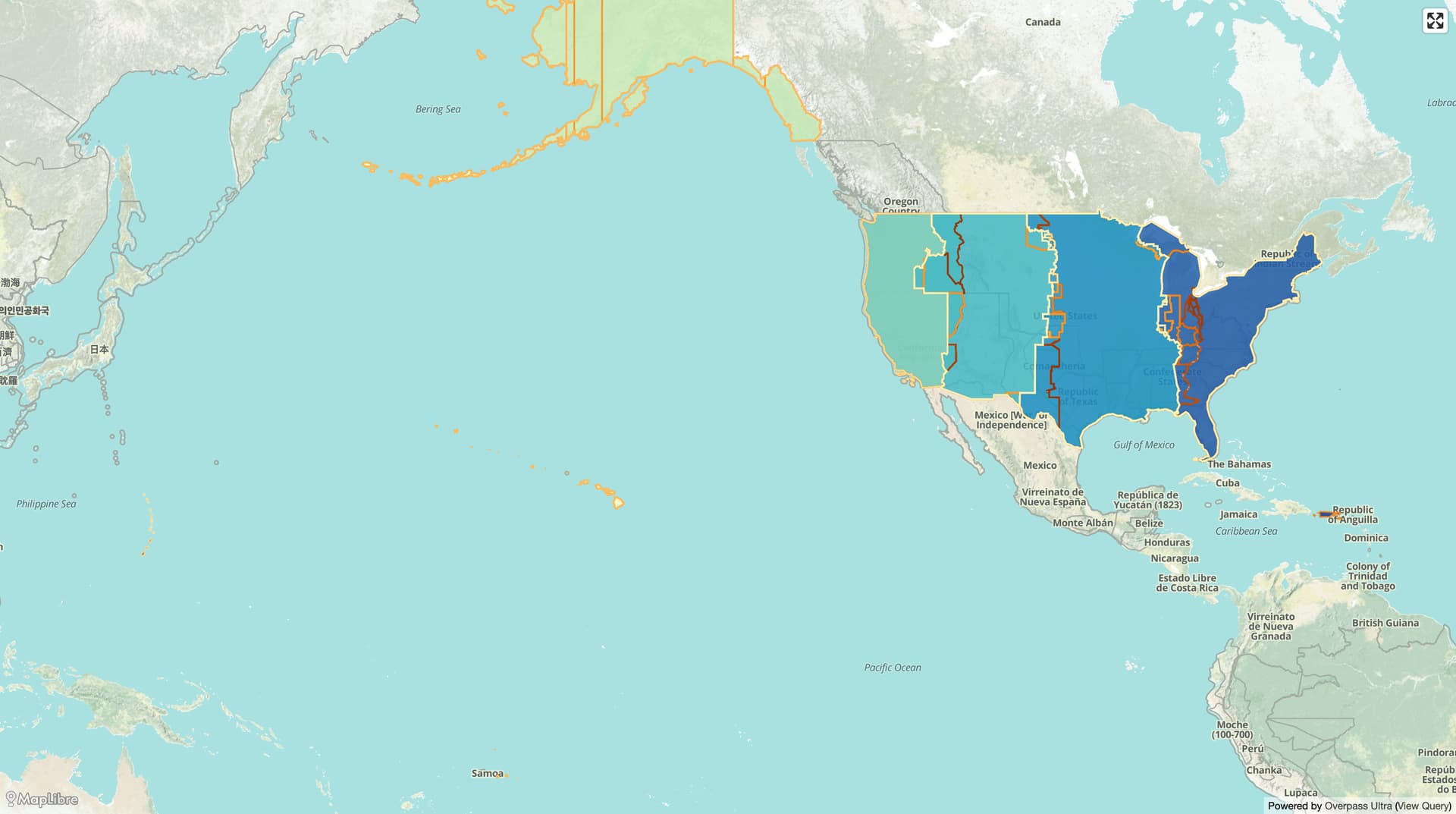
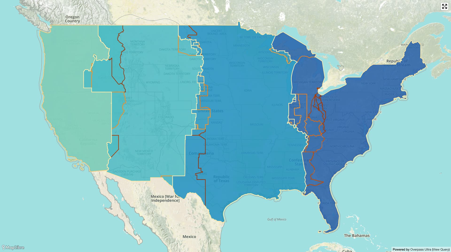
I spent the last month mapping time zone boundaries in the United States – not just the present-day boundaries, but also all of their previous versions, going all the way back to when the federal government began regulating timekeeping in 1919. In total, I’ve mapped 130 versions of nine time zones. As far as I know, OpenHistoricalMap might be the first comprehensive source of historical U.S. time zone boundary data on the Internet, and by far the most detailed.
Time zone boundaries don’t show up on the main OpenHistoricalMap rendered map, because we aren’t including them in our official vector tileset. But you can interact with them in Overpass turbo or Overpass Ultra.
Does anybody really know what time it is? Does anybody really care?
This has been a journey for me. I grew up in Cincinnati, right across the state line from Indiana, which was notorious for its incoherent timekeeping. Though all of southeastern Indiana had been moved to the Eastern Time Zone decades earlier, some communities observed daylight saving time while others did not, and some both did and did not observe it, depending on who you asked. This dramatization on national TV, of the White House communications director stranded and confused in Dearborn County, Indiana, wasn’t very far from the truth:
That corner of Indiana is completely Normal nowadays, but I’m reminded of this era every time I go on a road trip and pass a time zone boundary sign on the Interstate. Occasionally, when I come across OpenStreetMap’s coverage of “time zone” boundaries and need to make a few adjustments based on official time changes, I stop and admire the signs in street-level imagery too.

When you hear about a map of time zones, you may think of a classical wall map or globe with pastel-colored bands stretching from pole to pole, meandering across land boundaries. These are time zones in the sense of contiguous areas that happen to observe the same standard time, but not in the sense of explicitly defined boundaries. Along most of these colored bands, you won’t find a time zone entrance sign; if you do, it’ll be right alongside reminders of the country’s speed limits and customs rules.
The time zone boundaries have occasionally been the subject of controversy in OSM. If a time zone is just a collection of national laws arranged north to south, then this is secondary information that can be stored as records in a conventional database instead of as massive boundary relations in OSM. Within these bands are more formal zones defined by boundaries, which the Interstate Commerce Commission and later the U.S. Department of Transportation have managed to make as complicated as possible. But in most of the rest of the world, mapping time zones as boundaries must seem like overthinking it.
This misunderstanding came up again in January, when mappers argued for the wholesale deletion of time zone boundaries from OSM. In fairness, OSM had already strayed from a strict definition of time zones to indicate standard time observance, which has more practical utility. Whether a place observes daylight saving time is kind of a big deal, especially in Indiana. And some of the relations even stretched pole to pole, to emulate those colored bands on wall maps. What a pain to edit!
Falling into a time sink
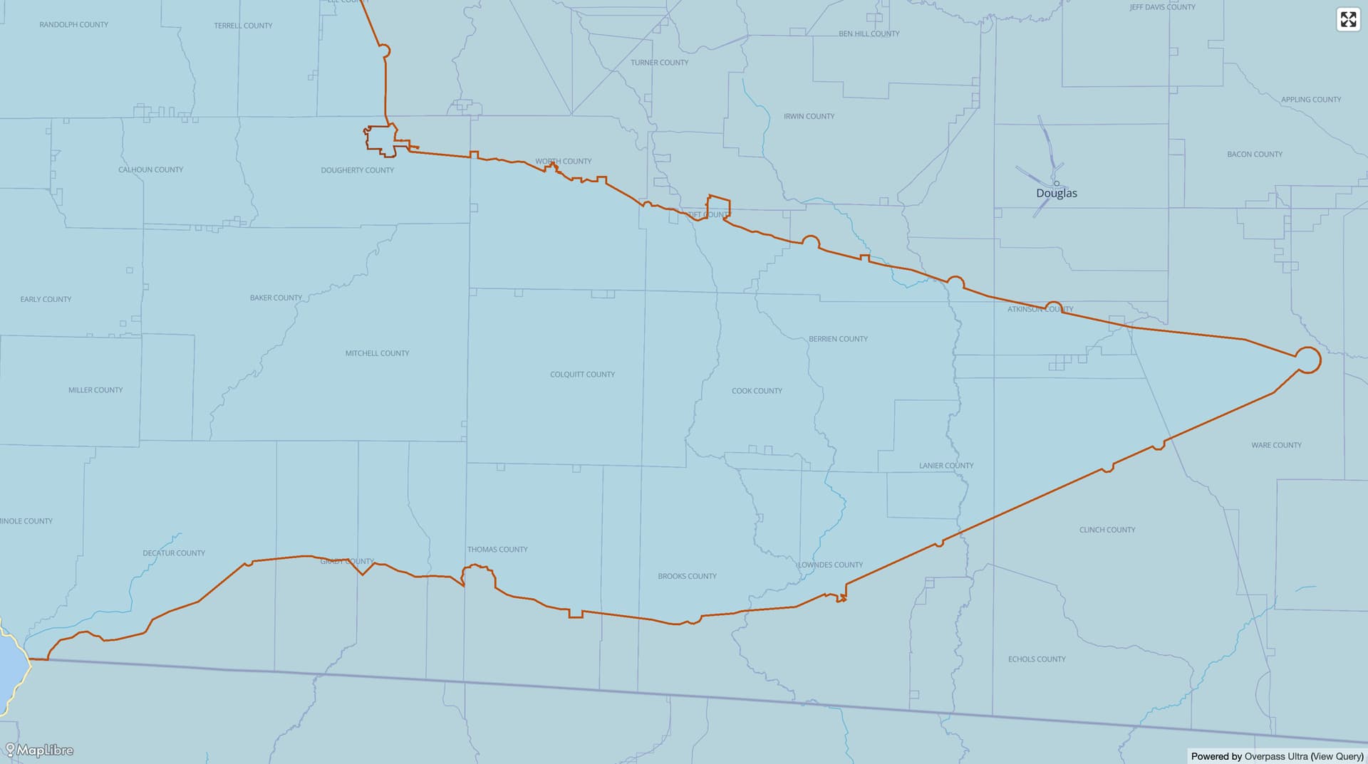
Pain aside, there are real time zone boundaries, and they’re an important part of the same maps that show political boundaries, highways, or railways. What’s more, they’ve changed very often over the years. I guessed that it would be pretty straightforward to add these boundaries to OpenHistoricalMap. After all, the U.S. Department of Transportation publishes an authoritative shapefile of time zone boundaries. All I needed to do was conflate these boundaries to the county boundaries that @jeffmeyer had just finished importing, since time zones generally change at county lines:
Despite being authoritative, the USDOT dataset wasn’t perfect. They seem to have put together the dataset by unioning county polygons that were a little rough around the edges, leaving gaps big and small. There were also some factual errors in Michigan and Florida.
After tidying up the present-day boundaries, I figured I’d just document my work so that someone else could someday finish the job. But this was unsatisfying, because OSM’s time zone boundaries already incorporate some history: every time the boundary officially moves, the affected region gets its own historically relevant “time zone” in the Internet-standard tz database, and thus in OSM. This isn’t really how boundaries work in the real world, but it simplifies processing for some software. This history extends as far back as 1970, the dawn of the Unix era.
To achieve parity with OSM, I worked backwards: each time a boundary change was officially gazetted, I copied the boundary relation and undid whatever was in the regulation to match the previous regulation. Since Pulaski County was added to the Eastern Time Zone in 2007, I redrew the new boundary on the other side of the county.
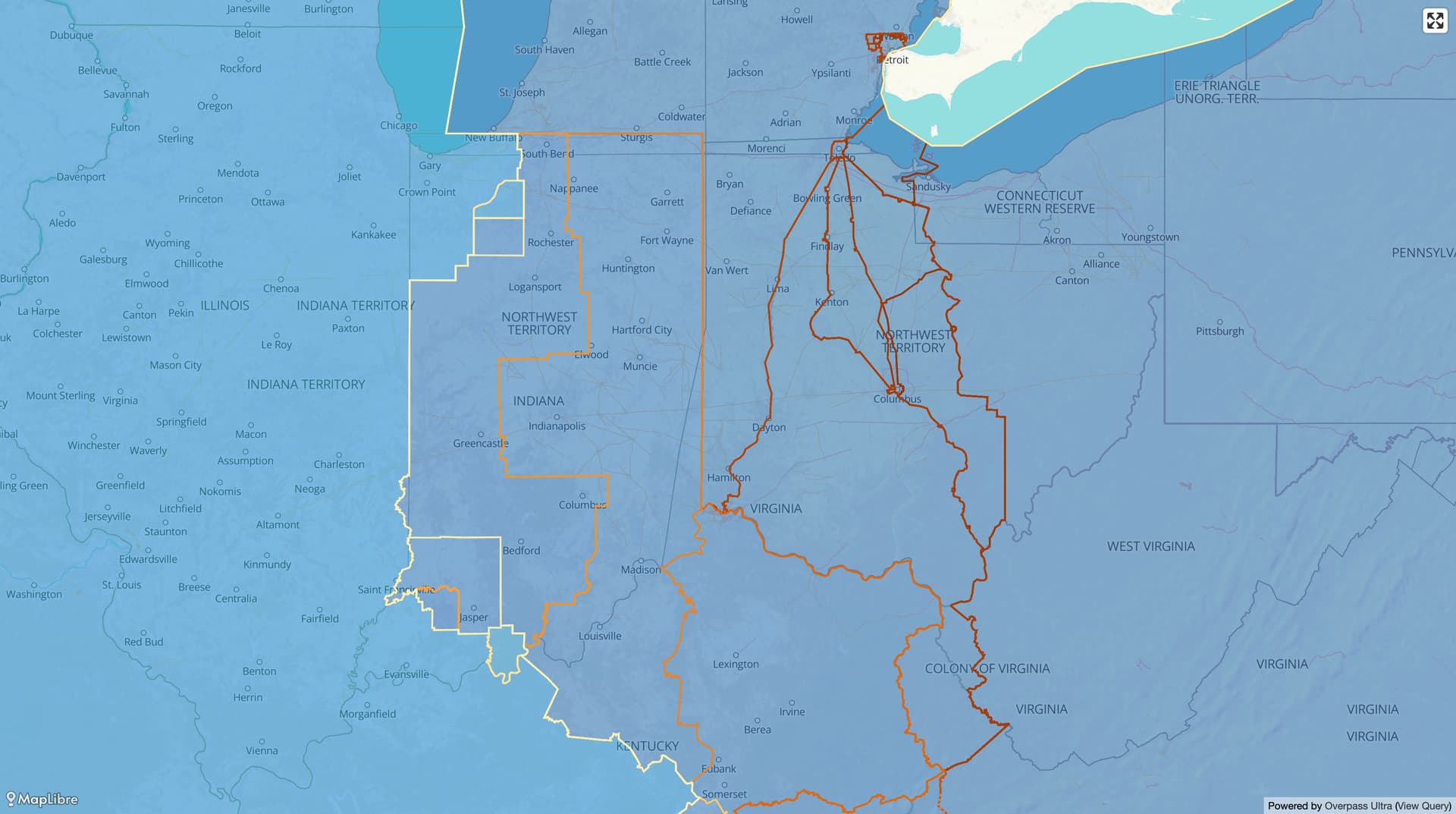
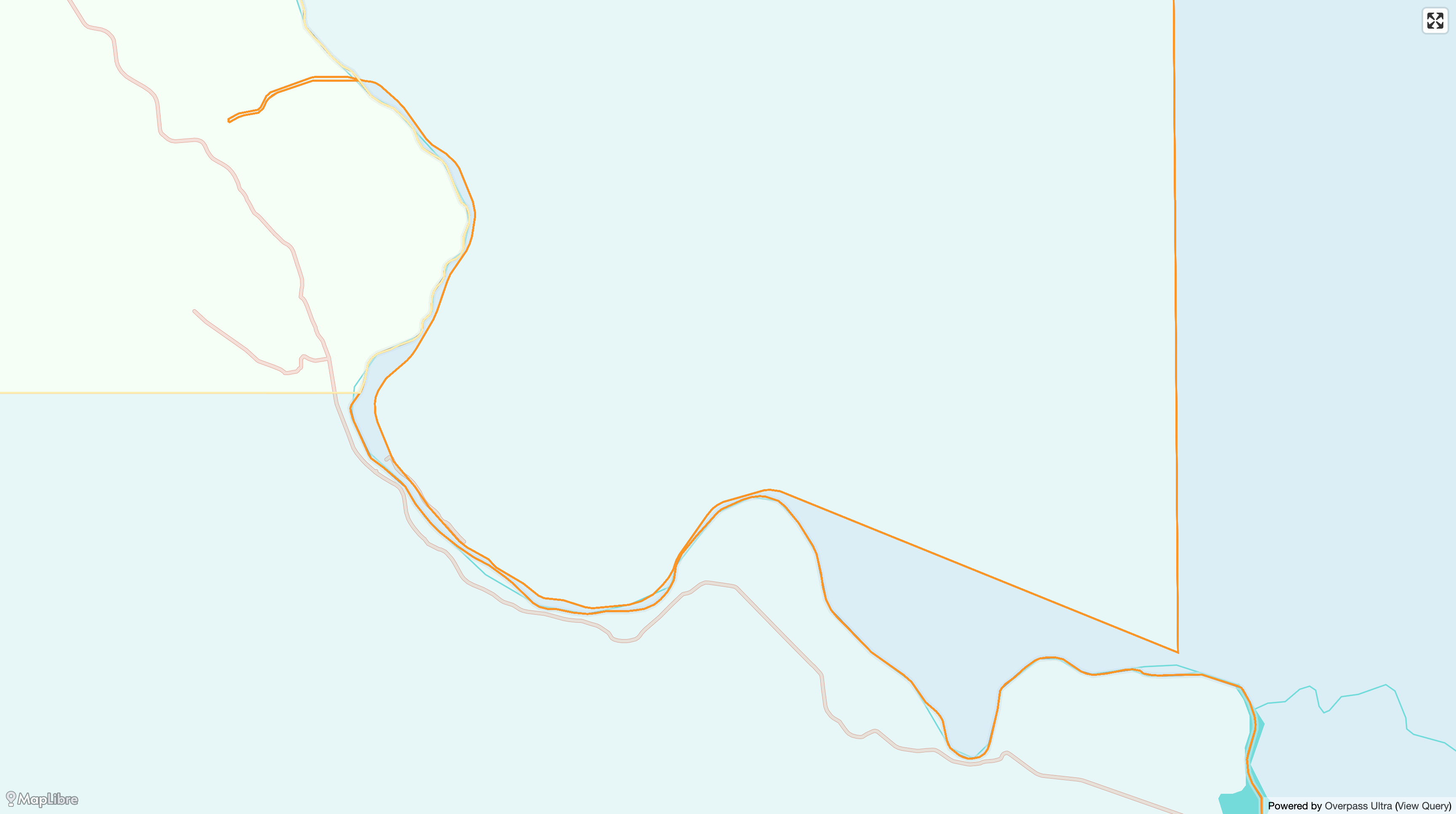
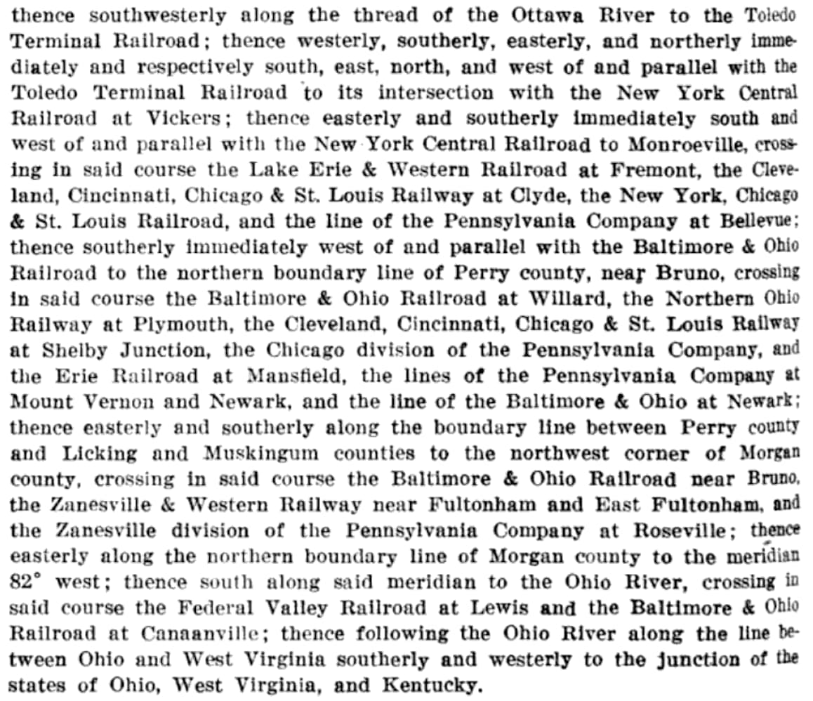
So far, so good. But after I worked backwards past 1970, I wondered how hard it would be to keep going. Turns out, very hard. The boundary descriptions began mentioning things other than county lines. Rivers. City limits. Abandoned railroads. PLSS range lines. The Continental Divide. “Somewhere around” an arbitrary coordinate pair.
![[Black]feet Indian Reservation; thence along the east line of said reservation, cross- ing the Great Northern Railway at Cut Bank, Mont.; thence following the easterly and southerly boundary of said reservation and Birch Creek to the Continental Divide; thence south along the Continental Divide to Gould, approximately 112 degrees 30 minutes west longitude and 46 degrees 65 minutes north latitude; thence southeasterly to Johns; thence southeasterly Immediately west of and parallel with the Great Northern Railway to Helena and to the most northerly northwest corner of Jefferson county, crossing the Northern Pacific Railway at Helena; thence following the northwest boundary of Jefferson county to the south boundary line of Powell county; thence south to Butte, there crossing the Northern Pacific Railway and Chicago, Milwaukee & St. Paul Railway; thence southerly immediately west of and parallel with the Oregon Short Line Railroad to the boundary line between Idaho and Montana near Monida. (51 ICC 297)](https://forum.openhistoricalmap.org/uploads/db6154/original/1X/54fb239923d26c966f169d2f589f51ec58d02a50.jpeg)
![[Mon]tana to its intersection with the boundary line between Idaho and Lemht counties, Idaho; thence southwesterly along the boundary line between the counties mentioned to the main channel of the Salmon River; thence westerly and northerly along the main channel of the Salmon River to the western boundary of Idaho; thence southerly along the western boundary of Idaho to its intersection with the boundary line between Wallowa and Baker counties, Oreg.; thence west along the north line of Baker county to meridian 117° west; thence south along said meridian to the Homestead branch of the Oregon Short Line Railroad; thence southerly immediately west of and parallel to said railroad to Blakes Junction, Oreg.; thence westerly immediately north of and parallel to the main line of said railroad to Huntington, Oreg.; thence easterly immediately south of and parallel to the said main line of railroad to the western boundary of Idaho; thence southerly along said western boundary to the main line of the Oregon Short Line Railroad between Payette, Idaho, and Ontario, Oreg.; thence southerly immediately west of and parallel to said main line of railroad to Nyssa, Oreg., crossing in said course the Oregon Eastern branch of the Oregon Short Line at Malheur Junction, Oreg.; thence southerly immediately west of and parallel to the Homedale branch of the same railroad to the west line of Idaho; thence south and east along the western and southern boundaries of Idaho to the Malad Valley branch of the Oregon Short Line Railroad near Woodruff, Idaho. Though located on the zone boundary as above defined, Huntington shall be considered as within the United States standard Pacific time zone. (78 ICC 608)](https://forum.openhistoricalmap.org/uploads/db6154/original/1X/eebae99ae52cc09573fee6773755d9f56bbee2bf.jpeg)
Despite our best efforts, not every railroad has been mapped yet, and survey lines are probably out of scope for this project. This was a great opportunity to pull up old USGS topographic maps. The topo map layer built into iD and JOSM is a curated selection of the most feature-rich maps, largely from the 1960s. But by then, many railroads had already disappeared without a trace. Fortunately, the USGS topoView service has digitized copies of every map that covered a given quad, sometimes all the way back to the 19th century.
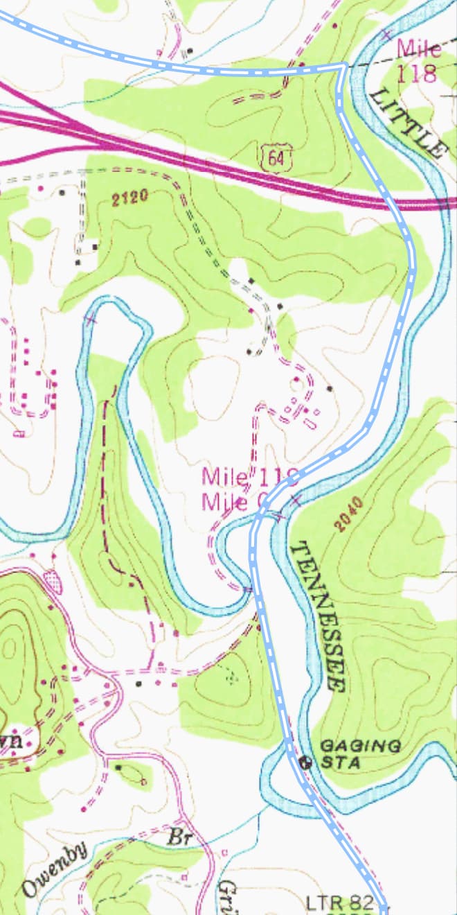
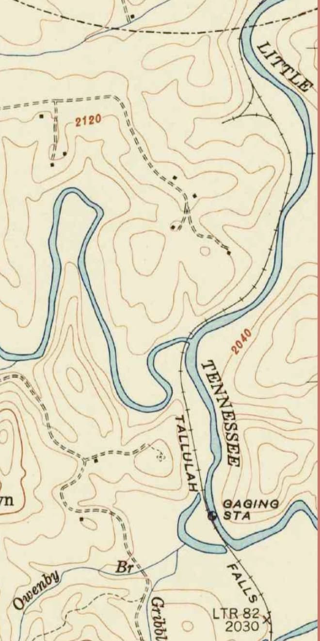
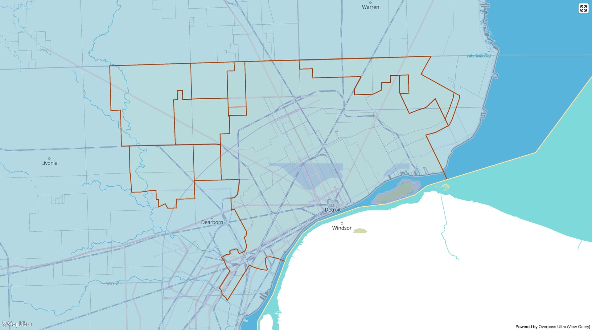
The topos also came in handy for sketching in the many city limits that the time zone boundaries followed. But wait – if city limits formed part of the boundary, what happened when the city grew and annexed surrounding neighborhoods? Based on periodic restatements of the boundaries by the ICC and USDOT, we can see that the description has continued to mention the same city limits without effecting any changes. Luckily, @matteditmsts had already imported the evolution of Detroit’s boundaries, but in Ohio, Columbus and Cincinnati required more research. One annexation got tied up in court for several years; I bet I know which standard time the litigants observed in the meantime.
That was only three big cities of the scores of municipalities whose boundaries have been incorporated into time zone boundaries over the years. But I didn’t have time to deeply research the histories of Dodge City, Kansas, or Asheville, North Carolina. I left fixme comments so that others from these areas can research their own local histories and hopefully come up with more precise boundaries.
Now you know
I never intended to dive deep on time zones, but I learned a lot in the process. I learned how to interpret Federal Register citations and other federal report citations, which will speed up research on other topics. I appreciated the analyses that the ICC and USDOT put together to justify their changes, drawn from the stories of individuals and communities that saw a quick fix to their economic woes in tweaking a boundary slightly to the west. I enjoyed getting my mind blown at the elaborate scheme by which Alaska changed time zones four times in as many hours one morning in 1983.
To cap things off, I put together an animated time series map of these boundaries using QGIS, as an excuse for learning QGIS. It fills a big gap in Wikipedia’s 20-year-old, grandiosely named article, “History of time in the United States”. I probably committed a litany of cartographic faux pas. It is something to marvel anyways.
A fixed-size map like this is a sad substitute for a real interactive map, but we need to bring more maps like this to Wikipedia via Wikimedia Commons, so that the public can more easily discover the richness of our data and learn how to participate. Still, if someone would like to stand up an interactive time zone map based on this data, it’s a lot more feasible now than it ever has been.
It’s probably time for me to move on from this particular subject, so now I turn it over to the community. Have Canada and Mexico similarly defined time zone boundaries as real boundaries in the past? What about other large countries that have been split among multiple time zones? How should we represent daylight saving time and other timekeeping quirks, if at all?
A project like OpenHistoricalMap doesn’t have to include information about time zones; it can probably meet basic user expectations by mapping other things that are commonly found on digital maps. But history has many dimensions. The more we’re able to fit into an elegant model of a historical map, the more interesting the basics become. While OSM debates whether to map imaginary lines inferred from traces of scraps of abandoned railways, we can map not only those railways as they existed, but also tangential topics like “railway time” that deeply affected daily life long after the railroad age.