Following the Atlas of Historical County Boundaries (AHCB), I extended U.S. county lines into the Great Lakes to reflect changes that the AHCB had cited but declined to map. In the process, I discovered a discrepancy in the eastern limit of Menominee County, Michigan, over Green Bay.
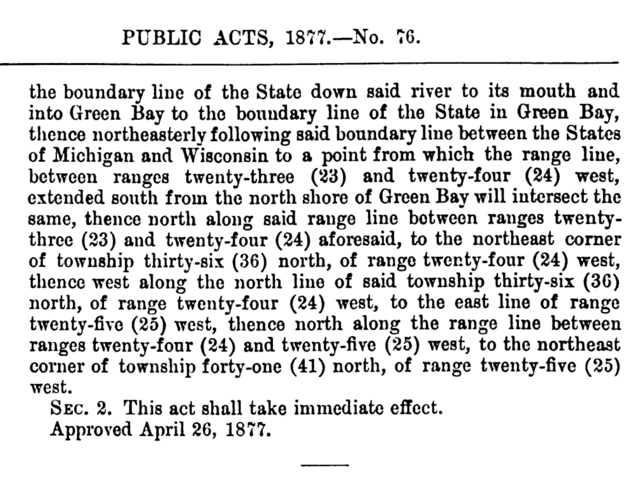
Michigan Act 75 of 1877 places Menominee County’s eastern limit at the PLSS range line between T36N R23W and T36N R24W. This 2023 document from the Michigan History Center, a state agency, gives the same eastern boundary.
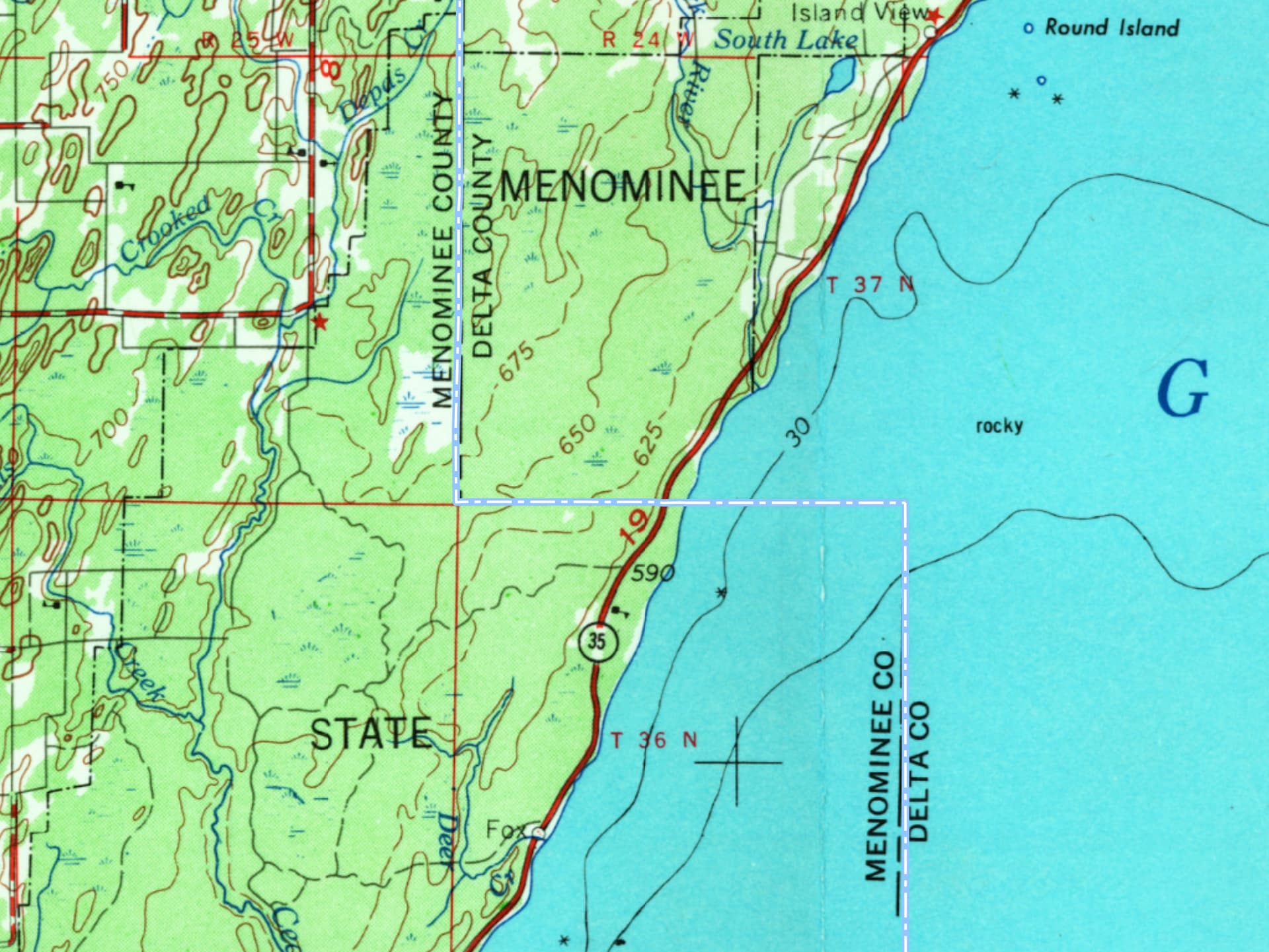
Using USGS topoView, I cross-referenced a historical USGS quad (1954 Escanaba, 1975 edition) to find the range line at 87°12′11″W:
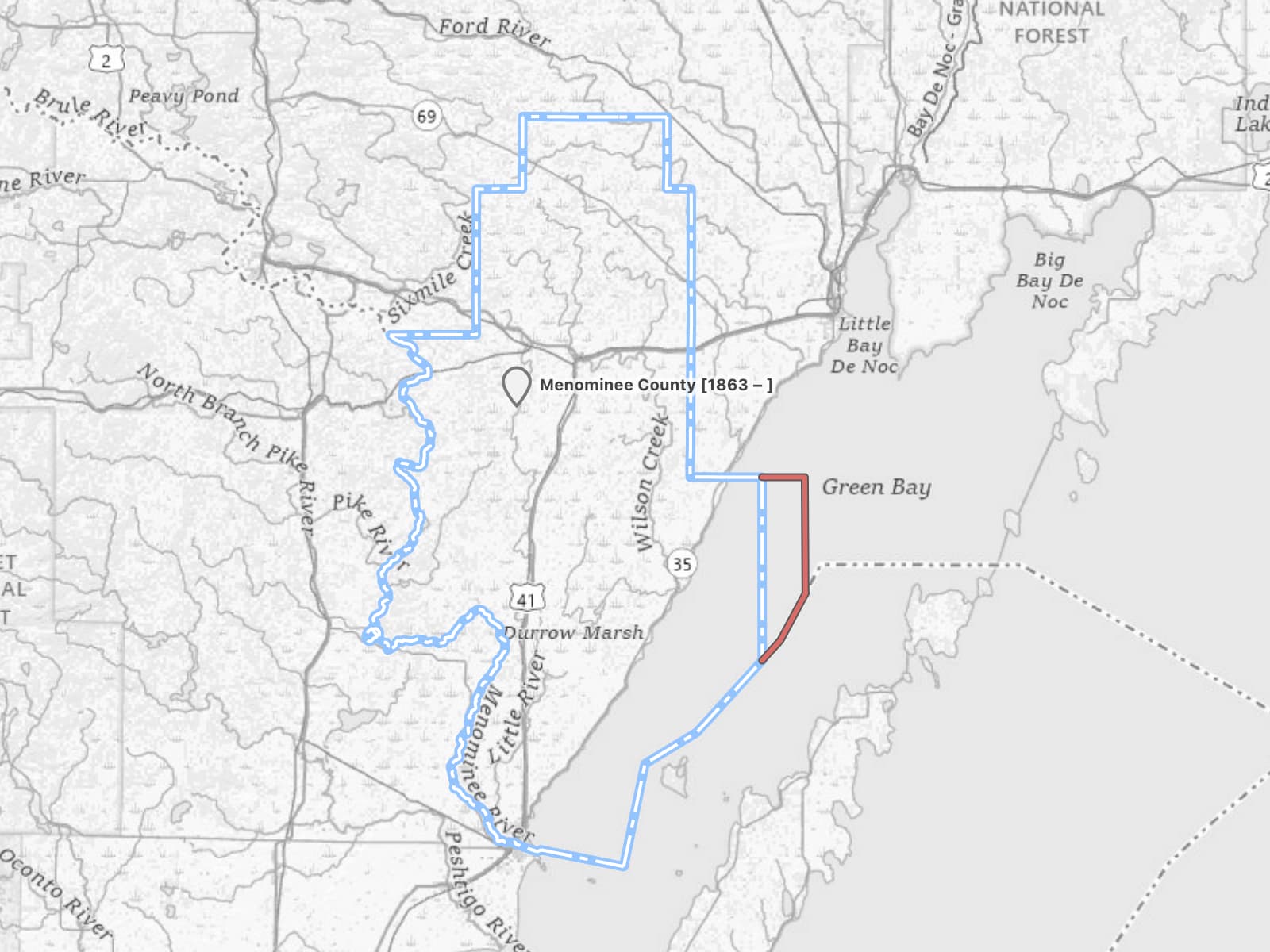
However, federal cartographic products including TIGER, the Boundary and Annexation Survey, and The National Map consistently show the county line more than 13 miles (21 km) to the east, at 87°7′45″W. These sources don’t include any survey lines, so it’s unclear on what basis they show the range line so far to the east.
What’s the big deal about a county line in the middle of Green Bay, without any islands at stake? For one thing, the boundaries in Green Bay were contested between Michigan and Wisconsin for decades before two Supreme Court decisions and an interstate compact finally resolved the matter in 1947.
If that isn’t enough reason to get this right, the boundary between the Eastern and Central Time Zones has also incorporated the county line by reference since 1973. The Bureau of Transportation Statistics recently informed me that our representation of the time zone boundary follows the westerly line, whereas their authoritative dataset follows the easterly line. Their data is based on the National Geospatial Asset Dataset for boundaries and ultimately from a submission by the Michigan state government.
How do we reconcile two versions of the boundary, both ultimately coming from the same state government? Unfortunately, OpenStreetMap is no help, because the local community long ago came to the conclusion that county boundaries do not extend into the Great Lakes. There’s overwhelming evidence that they do extend into the lakes, so we definitely shouldn’t painstakingly redraw them to hug the shoreline as OSM has.
Probably the best way forward would be to find more sources indicating the survey lines in this area and reach out to a state GIS agency for their take. It would be great if someone local to Michigan could take on this effort. We’re still missing lakeward boundaries of some of the other counties, so this could be an opportunity to proactively avoid similar discrepancies elsewhere.