Here’s a compilation of topics around how OHM should depict uncertainty and boundaries.
My take is that if we come up with a basic consensus around a tagging and rendering treatment, I think we could come up with a much more interesting map, especially with the number of historical boundaries I’m anticipating we’ll import in the coming months.
Indeterminate Boundary Treatments for OHM
see also:
- OHM Issue #204: Need a smart, sensitive approach for representing indigenous peoples’ land relationships
- OHM Issue #553: Need a way of highlighting disputed/contested areas
Reasons for trying to depict uncertain boundaries
- Irrelevance to culture and people being mapped
- Specific boundaries can have no basis in historically verifiable claims
- Differences of historian opinion about location & desire to show multiple views at once
- Land disputes of any sort
Solution process
The primary goal of this forum topic is to identify a path for a solution, both in order to work on that solution and to have an approach we can coherently discuss with partners.
As this question has been percolating for almost 3 years without resolution, I recommend we consider anything incremental that moves us forward even a little and doesn’t block us from a “better” long-term solution. Any number of maxims apply here: “Don’t let the perfect be the enemy of the good,” “Shipping is a feature,” “Move fast and break things,” etc.
How to tag uncertainty with certainty
Reasons for uncertainty
Whether the source of the uncertainty matters needs further discussion. For now, this is a non-exhaustive list of reasons for uncertainty for consideration and thought:
- Boundary itself is unknown
- Boundary is disputed by on the ground parties, such as those during wartime or even in less contentious dispute resolution processes
- Boundary is disputed by historians with multiple opinions or conflicting evidentiary claims
- Boundary is irrelevant to those being depicted
Indeterminate geometry considerations
- Points: indeterminate points can be grouped together in relations. The options for rendering these in a way that reflects uncertainty needs more thought.
- Lines: Boundary edge segments can be of differing levels of confidence. E.g., the 48th parallel is a well-defined boundary (even if the US-Canada border does not follow that line exactly), while older boundaries, such as “the top of a mountain ridge between river X and valley Y” might have been enforced a little more loosely in the medieval period. Or, a boundary can be disputed along a particular subsegment of the entire boundary.
- Areas: areas seem to be the most straightforward for identifying disputes.
How to tag is currently unclear
From @1ec5 at #553:
As far as tagging, OpenStreetMap has more or less settled on disputed_by, claimed_by, and to some extent recognized_by, but the values are still up in the air. The proposal was limited to countries with ISO 3166-1 country codes, so it didn’t consider subnational disputes and obviously didn’t consider disputes between historical entities. I’ve been quietly bucking that consensus around country codes by mapping disputes between a city’s neighborhood councils.
OSM data consumers such as OpenMapTiles use these tags to filter boundaries according to an American worldview, Chinese worldview, etc. Is there a view towards doing something similar with OpenHistoricalMap, or is the intention more to display the parties’ names to the user? If the latter, then maybe integration with Wikidata would be less messy in the long run. We should ensure that every disputed territory is linked to a Wikidata item specifically about that dispute and not about tangential topics, as in some of the examples above. Then we could rely on Wikidata statements like territory claimed by (P1336), item disputed by (P7378), statement supported by (P3680), and statement disputed by (P1310) to come up with the list of parties pretty straightforwardly in the inspector.
No practices from OpenStreetMap seem heavily used
OSM Taginfo for:
claimed_by: <700 usesdisputed_by: <1600 uses
Rendering obstacles and solutions
Areas vs. lines
As described above and suggested below, both areas and segments or boundary lines may be disputed and best be rendered differently from undisputed areas and lines.
Depiction at various zoom levels
As discussed by @jeffmeyer in #553, whatever treatments are used do not necessarily need to be the same at all zoom levels:
I’m open to whatever suggestions we have for approaching this, but I’m thinking that it doesn’t need to be apparent for too deep of a zoom, or that maybe there are different treatments at different zooms - e.g.:
- browser zoom 4-8 = transparent area highlight
- browser zoom 9-12 = some sort of transparent pattern (diagonal lines?)
- browser zoom 2-3, 13-20 = nothing
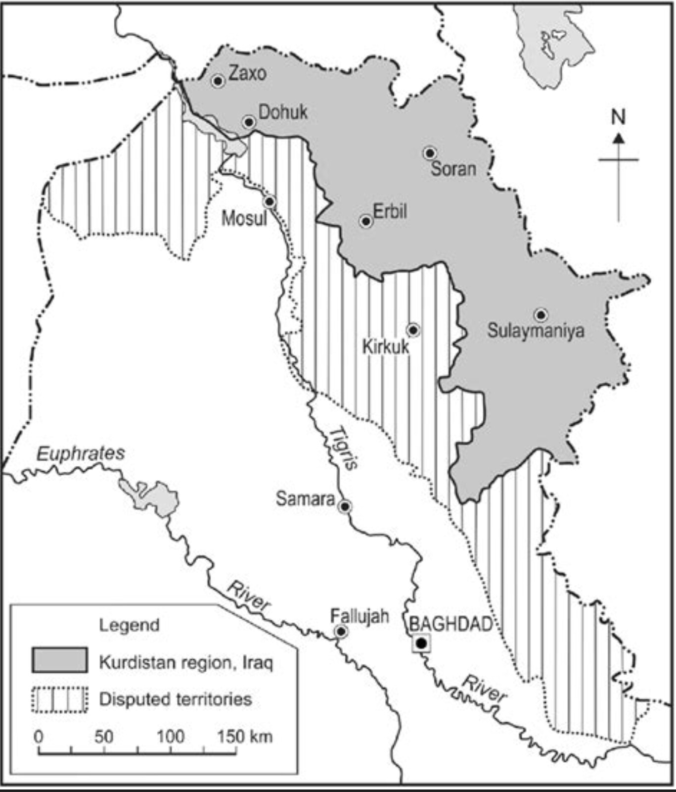
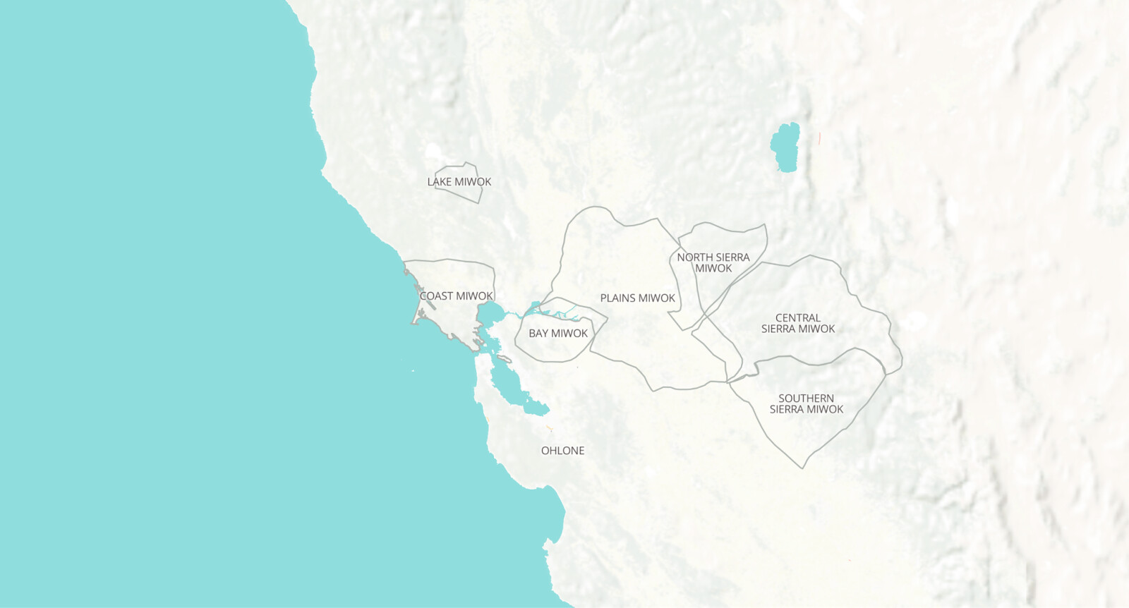
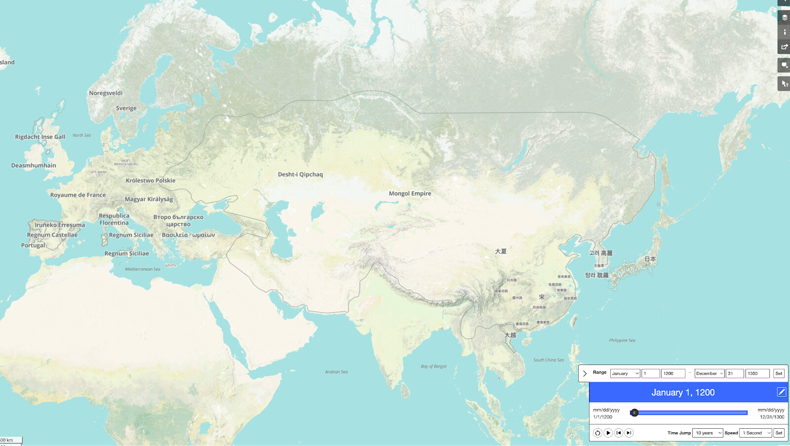
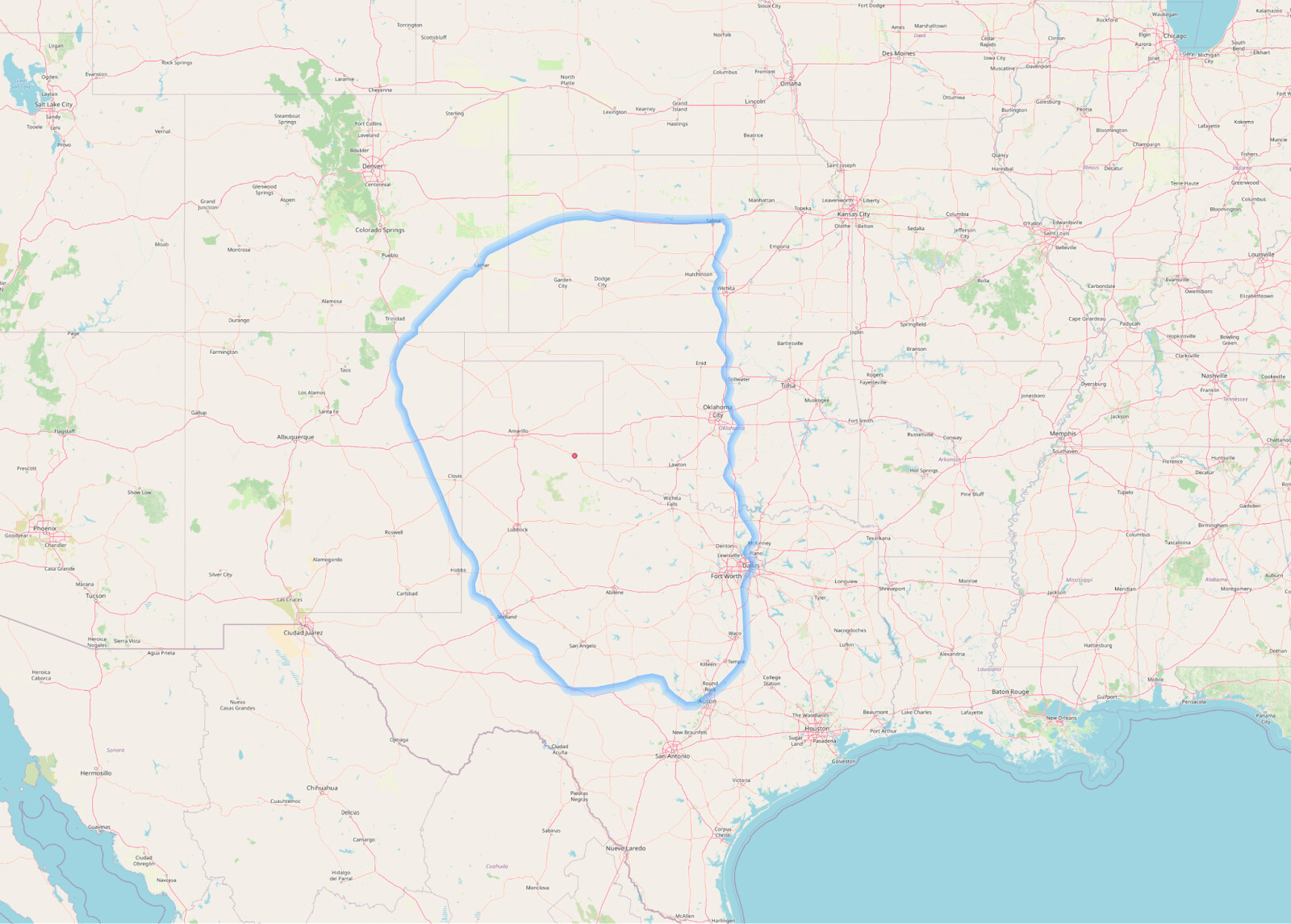
Examples on OHM today

Possible alternative treatments
Considerations:
- Not all treatments have to show up at all zooms – e.g., there could be a zoom level dedicated for large-area territorial disputes that emphasizes / highlights the disputes, while the disputed areas are more muted at other zooms.
- Not all disputes have to be treated the same way. Maybe there’s a special type to call out disputes like large-area wars.
- High contrast to the basemap color is used in mockups, but may be less helpful in production.
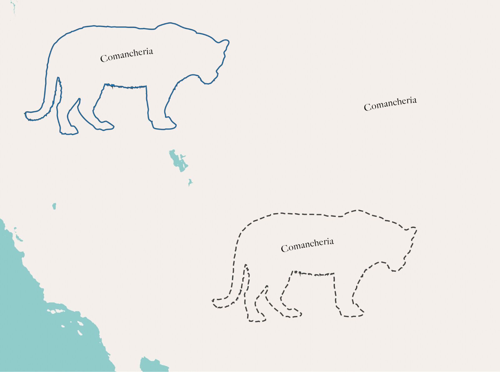
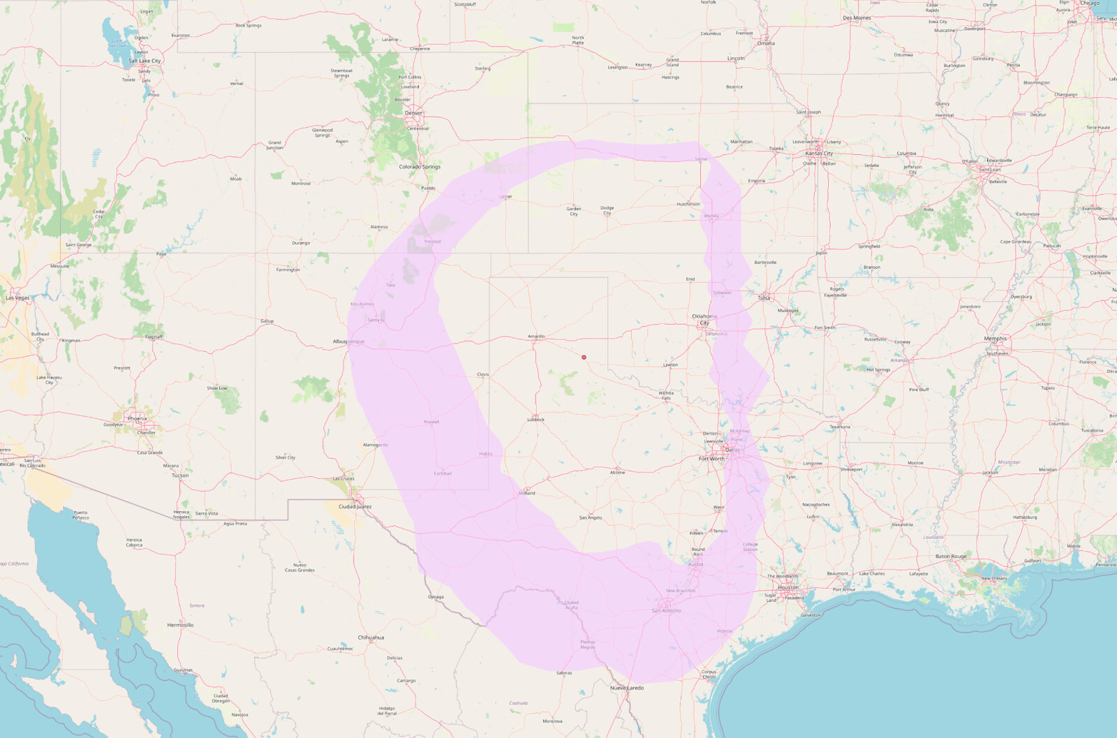
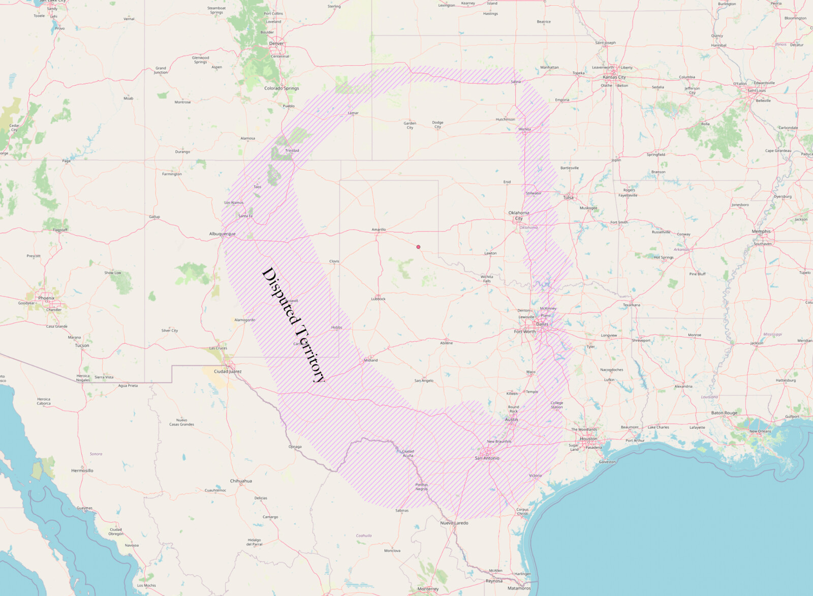
Text following a curve implies some area of coverage, even without lines.
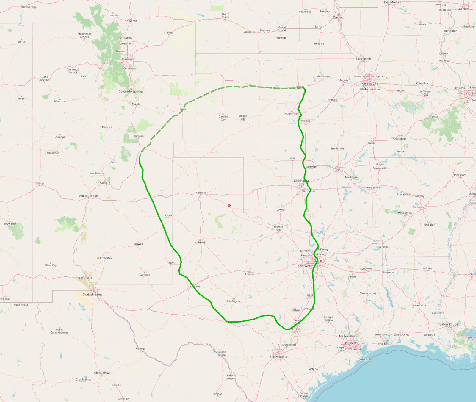
Changing boundary styles by segment could reflect varying degrees of confidence - note the dashed segment on the northern side of this boundary.
Boundaries can have fading effects to show indeterminate nature.
Or a varying offset to show min and max estimates of reach
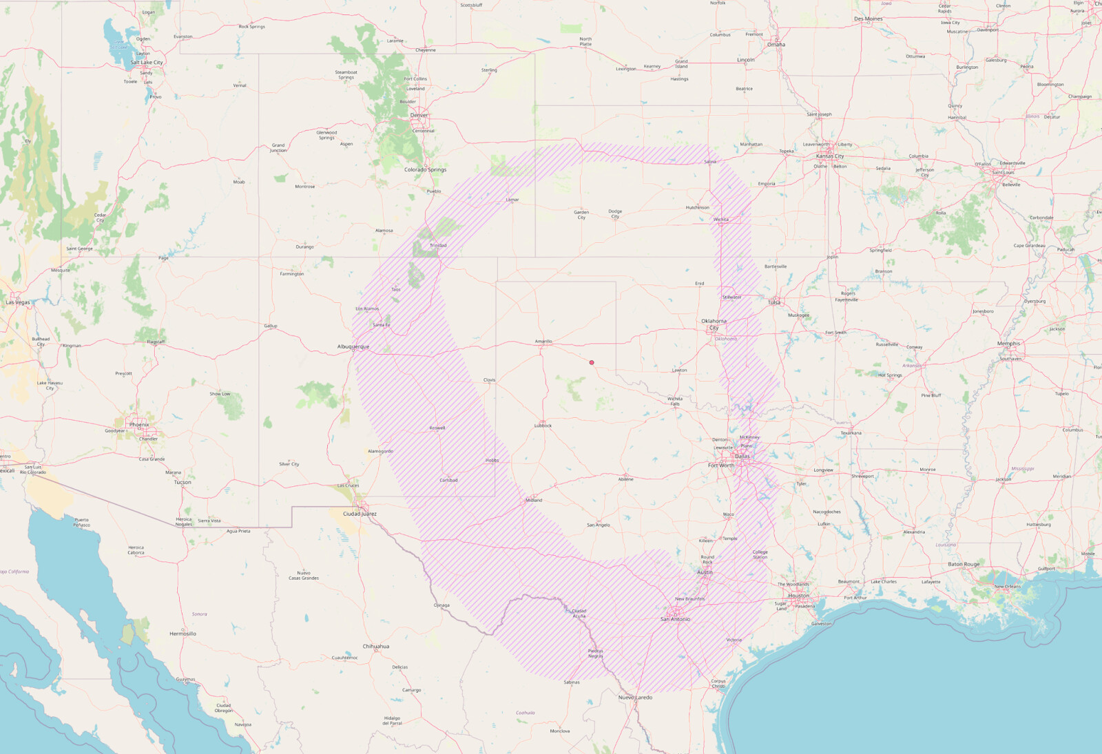
Or a pattern instead of a solid.
Or, a combination of treatments.
Comparables