“If you want to make a friend, ask someone for a favor” - old wisdom passed to me by a wise old friend.
One of the reasons I’ve always been interested in this project is that it’s a great excuse for starting a conversation with interesting people. And, the cool thing is that there are all kinds of people who want to be helpful. Given that mapping on OHM can quickly tap the limits of what’s been digitized, people who can point you toward answers are an incredibly valuable resource.
To that point, I’d encourage everyone to reach out for help when they hit a wall in finding sources for their mapping. Sometimes, you just have to send an email, pick up a phone, or knock on a door.
Here are some email exchanges I’ve had recently, as well as an example of a mystery I’m still tracking down.
Glaciers in Glacier National Park not matching any USGS vector data
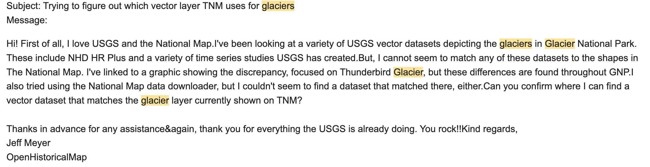
I was baffled as to how the glaciers included on the USGS National Map didn’t match any of the vector data sets I could find, not NHD, not any of the USGS observations, nothing. So I sent a note to the general USGS help email. I had zero faith that a web form would yield a reply. But… it did. My note was forwarded first to the National Map team, then to their hydrology and glacier expert, who provided the info I needed!
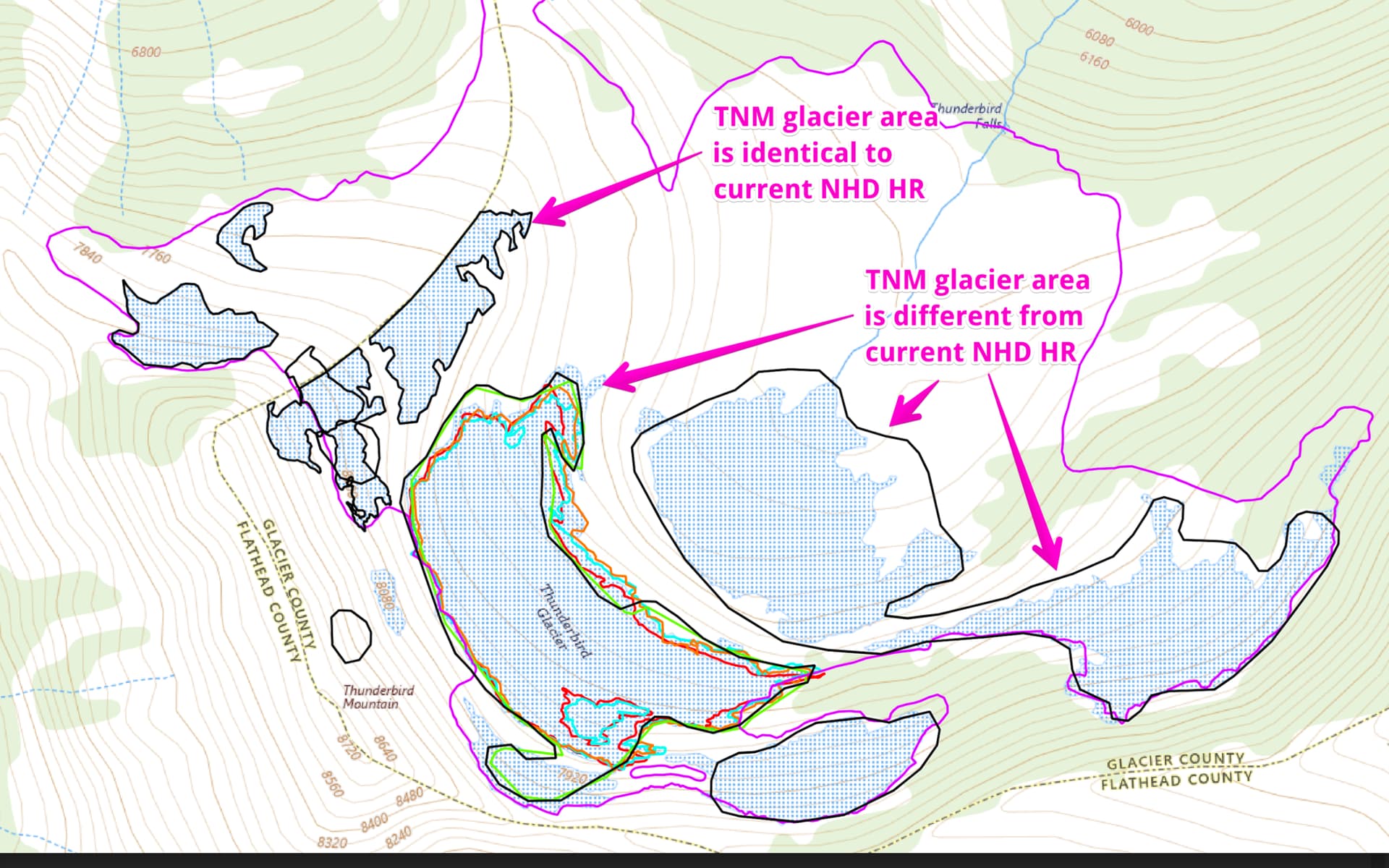
My note:
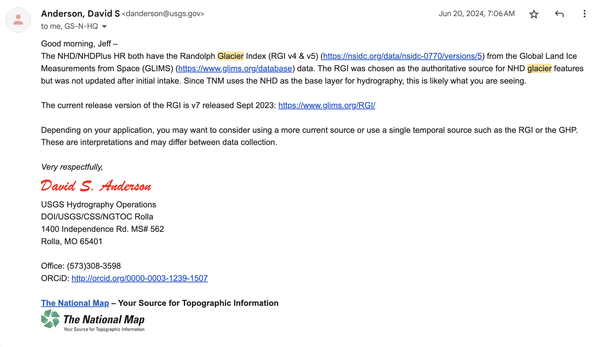
The answer, after several forwards:
No WMS or WMTS for Historical Aerials in Cumberland County, NC
As part of mapping the history of some highways in North Carolina, I found some great historical aerial layers that were available only as an ESRI REST layer, which was great for viewing in QGIS, but not in JOSM, which only supports WMS, WMTS, TMS, and MVT imagery layers and a plugin can support GEOTIFF.
So, I sent a quick note to the very impersonal and robotic contact email ccgis@cumberlandcountync.gov. Again, I had zero expectations for any sort of timely response.
Boy, was I wrong: under 3 hours later, they had hooked me up and I was in business!

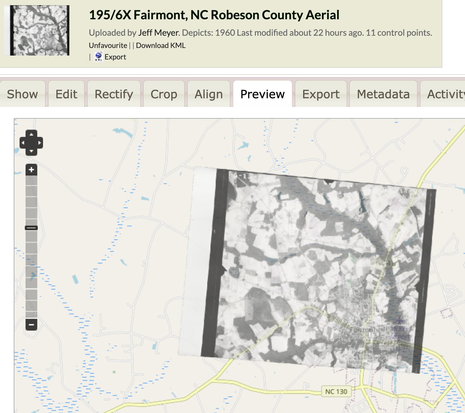
Historical aerials in Robeson County, NC
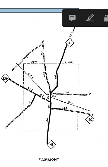
The North Carolina Department of Environmental Quality has a page for historical aerials, but doesn’t host any sort of online viewer. They do, however, scan old aerial images. A quick note verified there was no cost, so I asked for 3 points and within a day, I had a link to aerials I could upload to mapwarper.net and georectified. Here are a couple results: I-95 under construction in April 1960 at an intersection with U.S. 301, and Fairmont, NC in May, 1960 (following U.S. 301).
Diagonal-to-plan street in Fairmont, NC
One of the reasons I wanted to see Fairmont, NC in 1960 (or as far back as I could) was because I’m mapping the history of U.S. 301 and thought there was no possible way Byrd Street was part of the original plan of Fairmont. It looked to me like some sort of modern convenience, put in to connect a northern and southern artery that didn’t connect neatly for through traffic.

Because Fairmont is a small town, there aren’t any old city maps online that I can find.
So… time to reach out. I’m going to call the local library, reach out to a Fairmont, NC history website, and the city planning department (maybe there’s an original plat map?) to see if I can find out if my hunch is correct or not.