Thought it would be useful to start a post about this, because its come up a few times recently, and we’ve had a discussion on GitHub about it in the past as well. Please chime in with any thoughts or other examples below!
The problem
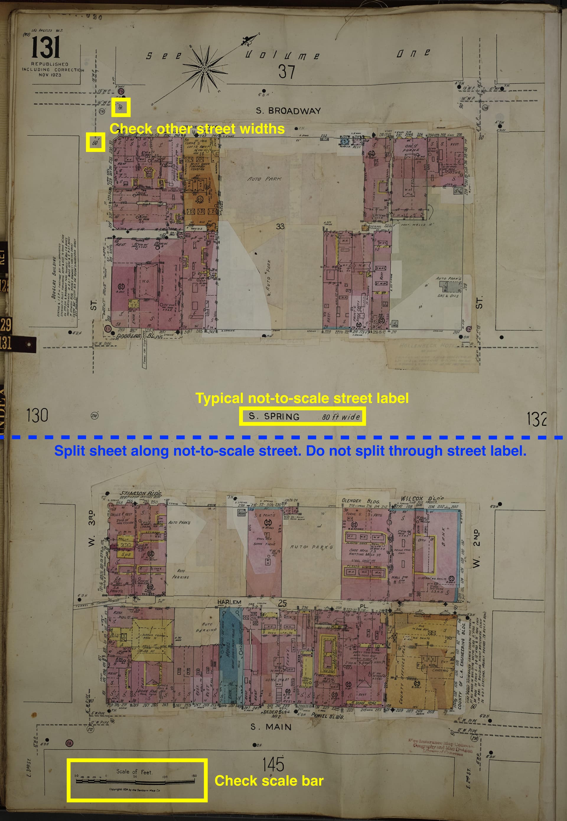
Basically, the issue comes down to the fact that Sanborn maps are almost always drawn very accurately and to scale, so we kind of forget that sometimes some parts of them absolutely aren’t. From what folks have observed over the last couple years, here are two common places the scale breaks down:
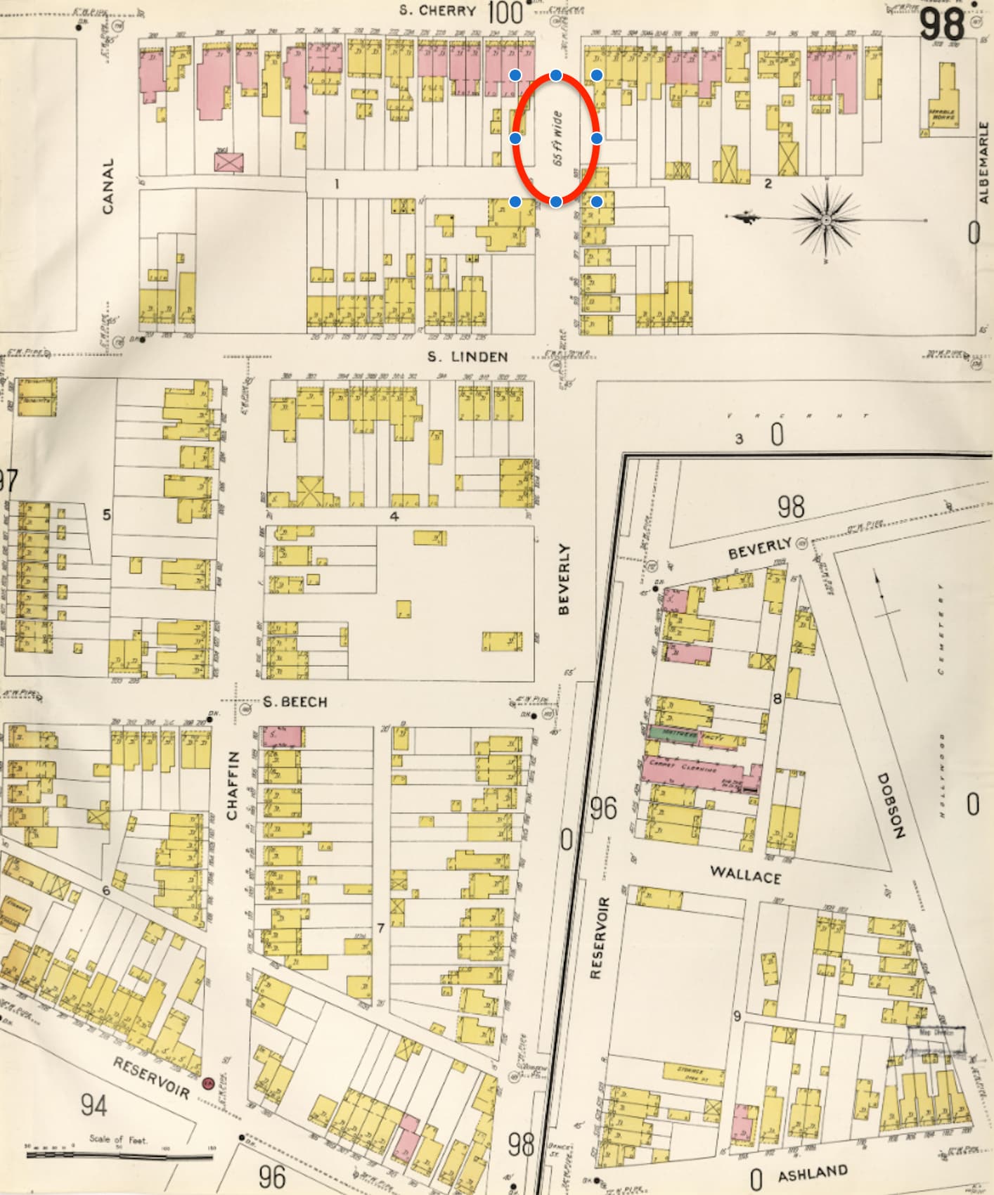
- Street widths
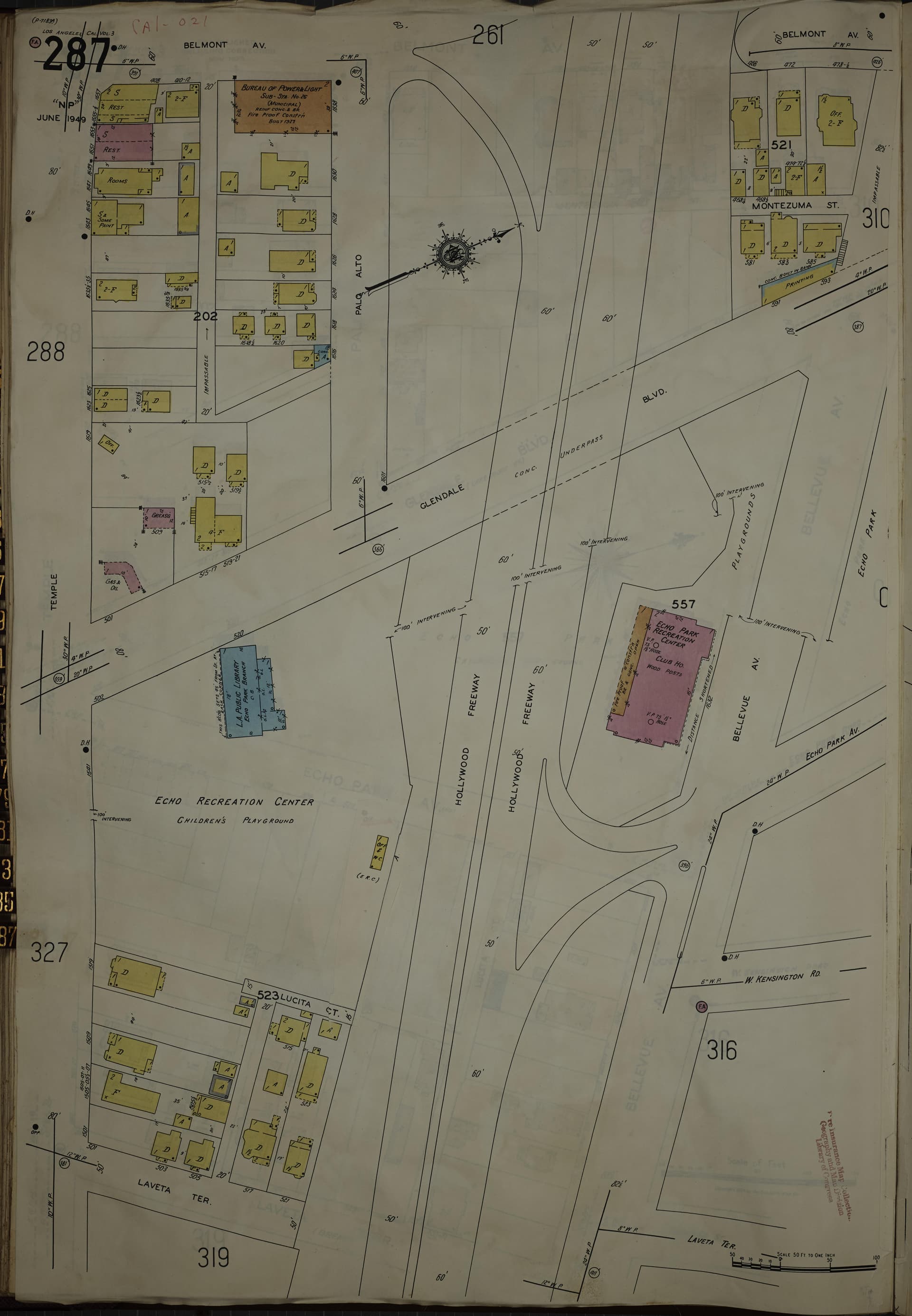
- Isolated buildings off in space
My impression is that the reasons for these inaccuracies are
- Save space on the page by condensing open areas
- Conversely: Artificially inflate the width of streets to… give more room for on-paper annotations by the companies who used the maps? Not really sure.
Strangely, San Francisco seems is the only place I’ve see where every street is drawn way too wide. Because the base property boundary fabric seems to be reused for every edition, perhaps an early SF edition was drawn with wide streets for some specific reason and then those widths just persisted into later editions.
Handling these discrepancies…
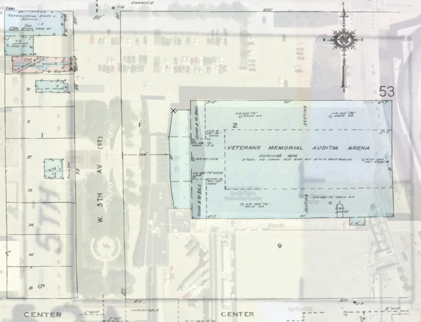
Of course, the georeferencing process doesn’t tolerate such an inconsistent scale (no reason it should). Just to illustrate, here’s an example where you can see the streets are much too wide (Leidesdoff and Halleck, and one block is even a little offset to the north):

If you were to try and force those small blocks into the right location, it would be a mess.
In these cases we’ve found these pages need to be split down the middle of the street, and, ultimately, georeferenced block-by-block ![]() . To make it this possible in SF I’ve added a parcel boundaries reference layer to the San Francisco interface (red lines in the screenshot above), and that does really help the process. Eventually there will be a better system for adding snappable reference layers to any city.
. To make it this possible in SF I’ve added a parcel boundaries reference layer to the San Francisco interface (red lines in the screenshot above), and that does really help the process. Eventually there will be a better system for adding snappable reference layers to any city.
For now though: Any other salient examples that you’ve come across? Feel free to share below.