I know about 2 years ago it was requested to make railways more prominent on the map. Which was a very valid request back then, they were barely visible.
But now they are way too dominant, and as I’m mapping more highways this is becoming very apparent.
I had the same thoughts. The railroads dominate the highways, even though nowadays highways are the most important. It’s fun mapping railways when they’re so easy to see but it’s not very realistic.
I am in agreement. They are just a little too heavy, especially at lower zooms. I would also like to see ‘industrial’ lines more differentiated and disappear a little earlier at lower zooms.
There is a new OSM vector renderer that does a nice job of the railway/highway balance (although the visibility of industrial lines is reversed) and a nice job overall. In demo mode, needs refinement and lacking features: https://vector.openstreetmap.org/demo/shortbread/#9.62/-32.3004/150.8842
I also want to point out that we have a functional railway layer which also includes highways in the background. (and even ORM). In busy areas roads aren’t even visible on multiple zoom levels.
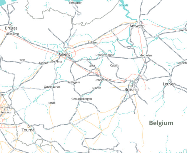
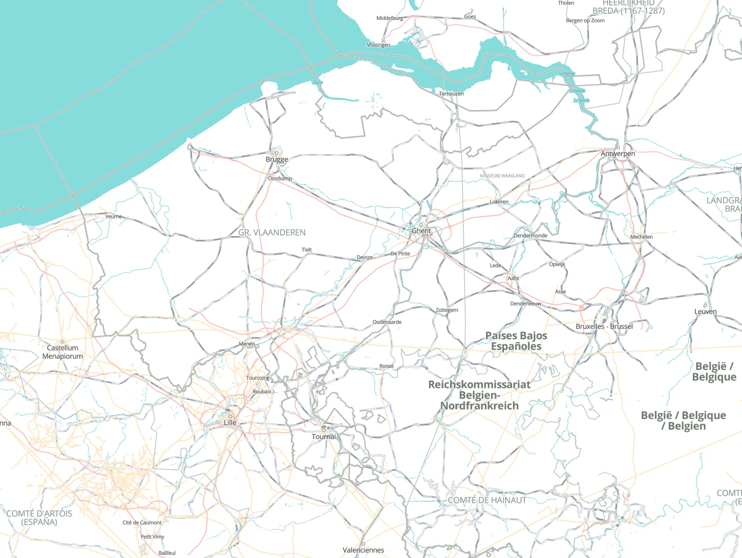
Part of the problem in Belgium in particular is most of the lines are tagged with usage=main (I have no idea if they actually should be). The area is quite dense though so it’d be a problem even if they weren’t.
I think the current style works quite well at zoom 11 (...openhistoricalmap.org/#map=11/...) and above but at 9 and 10 they’re just too prominent in dense areas like Belgium, England, parts of Germany etc – they overwhelm admin boundaries (especially at admin_level≥5), rivers etc as well as highways and often make the town labels a bit harder to read.
I think the way they’re displayed – a black-and-white stripey route with a thinner outline – almost makes this inevitable as there’s a minimum number of pixels that can be used to do that. Highways by contrast can be much thinner. We can’t just make them non-stripey though as then they’d be pretty indistinguishable from the admin boundaries.
I think that goes too far the other way. Rail used to be much more important than it is today and OHM needs to reflect that. It might be good for, say, a specific political map style or something if that is ever implemented though.
Yes all of those lines are mainlines in Belgium. It’s other neighboring countries that are tagging mainlines as branch. (I assume because it makes them less dominant graphically?)
We can’t just make them non-stripey though as then they’d be pretty indistinguishable from the admin boundaries.
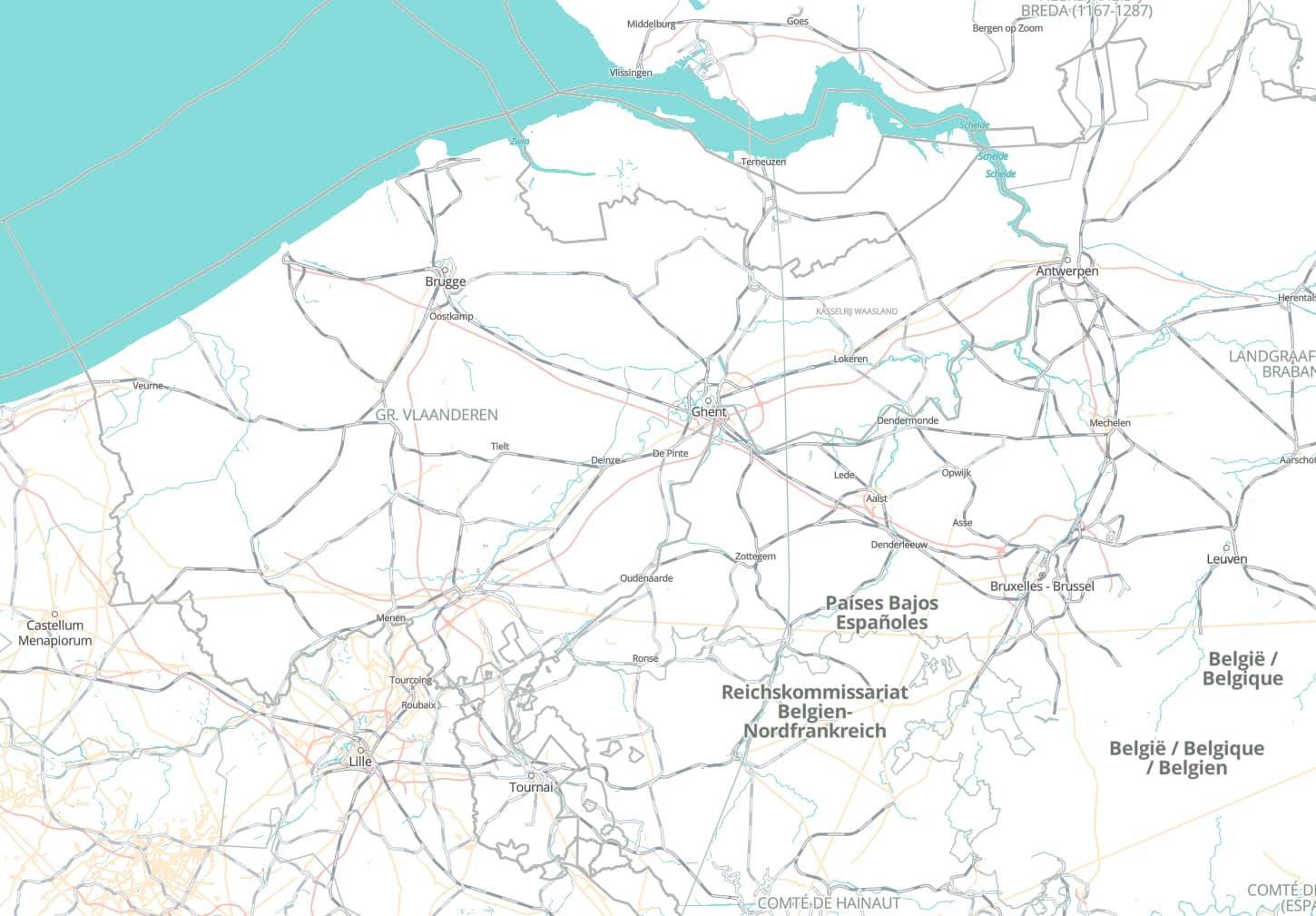
I don’t think making them a simple black line will make them indistinguishable from borders, see OSM (picture below). The problem here is yet again (I’ve mentioned this a few times the past couple of months) that we’re trying real hard to build a mapstyle from the ground making all the same mistakes OSM made 2 decades ago, instead of just learning from OSM.
Rail used to be much more important than it is today and OHM needs to reflect that.
(see image below) imagine OSM without the highways. (so pre 1950-1970), the railways dominate the map, which is what we’d want - without doing anything special. Then as the highways get introduced they get to share the dominance with them.
I think it’s just that they aren’t tagged with usage=* at all. The renderer just draws them like branch lines by default.
Oh for sure. I’m not saying they couldn’t just be black/grey lines in general. I am specifically meaning in the context of the current style where admin boundaries are also solid grey lines. The issue is more with the admin boundaries than the rail itself.
Yeah, I have no problem with how OSM does it really, although I think it is a bit of a stretch to say “the railways dominate the map”. I was talking about the “new OSM vector renderer” AndrewS_OHM mentioned (see https://vector.openstreetmap.org/demo/shortbread/#9.62/51.09/4.348), which greatly exaggerates the motorways vs the rail. Also to be clear I’m using “highways” to mean highway=* and motorways for the modern (post-1950s) highway=motorway routes. At zoom 10 and above on OHM the motorways and rail are the same thickness (or at least very similar), which seems correct. Currently the rail is more obvious as it is darker against the light grey background. (When land use gets done it may be a different story.) At zoom 9 however the rail is quite a bit thicker.
The Historical and Railway styles currently depict railroad tracks according to the European tradition, which unfortunately also results in noticeable seams along tile boundaries. At one point, the Historical style followed the American tradition, depicting each track as a thin, solid line with tick marks representing rail ties (sleepers). This gave us more flexibility but got really messy around rail yards. At lower zoom levels, the lines looked too much like borders, so we switched to the European treatment.
Now that the tiles expose usage=* to the stylesheet, maybe we could restore the American treatment and vary the ties’ spacing and length by usage=* value, as on OpenStreetMap Americana. I don’t think this treatment is inherently incompatible with gray borders; these borders need some tweaking anyways to stand out from the style’s non-OHM-based terrain layer.
Now that we have a Railway style and work is getting underway on a community-developed road atlas style, maybe we aren’t too far from the point where secondary styles prioritize transportation while the main Historical style deemphasizes transportation just a little bit in favor of other themes such as political borders.
Railways do thin out at lower zoom levels, but only by a pixel:
Roadways vary much more in width, for example highway=trunk and highway=motorway:
At vector zoom level 7, both would be 3 pixels wide, but the two layers vary the line width differently, one linearly and the other exponentially. That makes it difficult to ensure consistent widths.