Is there a reason there’s no borders for China (or Qing Empire, or Qing Dynasty) before 1880? Or is it that no one has gotten around to it yet? It seems like a lot of Chinese history is missing, especially compared to how fleshed out Europe is. I have no idea about any of this but I might try and figure out how to contribute to Chinese historical maps back to the Warring States period if no one else is on it already.
2 Likes
I’m guessing most mappers are American or European, thus not a big interest in China. I myself live in a former British colony, so I’m mostly interested in mapping European empires.
My preferred method of mapping is to research all the name and border changes in a spreadsheet and then I create the list of tags in the sheet and copy them over into JOSM or ID. Here is my spreadsheet if you want to take a look or copy it.
Thank you! I may adopt this approach myself. Admittedly, I am no expert on Chinese history, or any history really (other than perhaps world history from 1900 onward). But I wound up here because I was simultaneously fascinated by the aims of this project and the state that has already been achieved in the US and Europe, and disappointed that the same could not be said for many other parts of the world. I feel like something I would like to see is a broad-strokes (even if somewhat inaccurate) outline of sovereign borders for the last 2500 years or so. Greater accuracy and refinement from that point would be much easier, and honestly the main thing that I wanted to be able to use OHM for was zoom out and scroll to see the state of the world at different points in time. I have a lot to learn first though before I will feel comfortable contributing. Thank you again for your assistance.
Hi @Soluna7 - made any progress here? I’d recommend diving in and giving it a shot, and then asking for review / help. General experience can build slowly, but specific experience can grow quickly.
Your idea of just using broad brushstrokes is a good place to start, as much of our understanding of past boundaries is either vague or hand-wavy anyway.
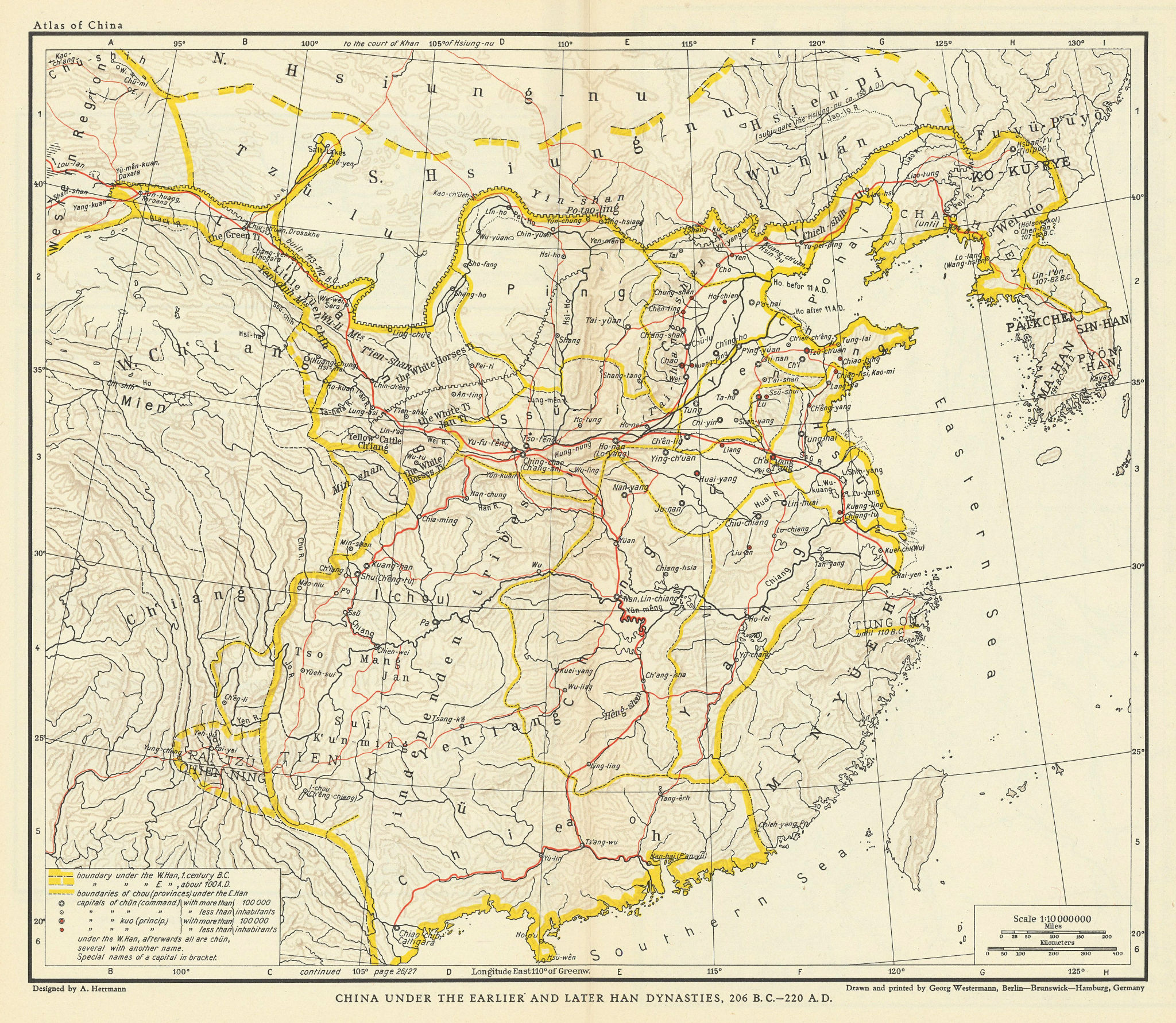
If I were new, I’d just start with one of the regions on this old map of China in the 3rd Century BC - third century AD. This map is interesting mainly as a baseline reference, as well as relatively easy georectification, and limited copyright restrictions (I think!).
Maybe start with 1 region / admin boundary, then add 1 adjacent to that to see how reusing shared segments can help?
I’m sure plenty of people here would be glad to help review your work!