Style updates!
Hello everyone, in the last month, we have added some style and data updates to the Historical (Main) and Railway styles. Data updates have brought in to the Woodblock and Japanese Scroll map styles as well.
Railway
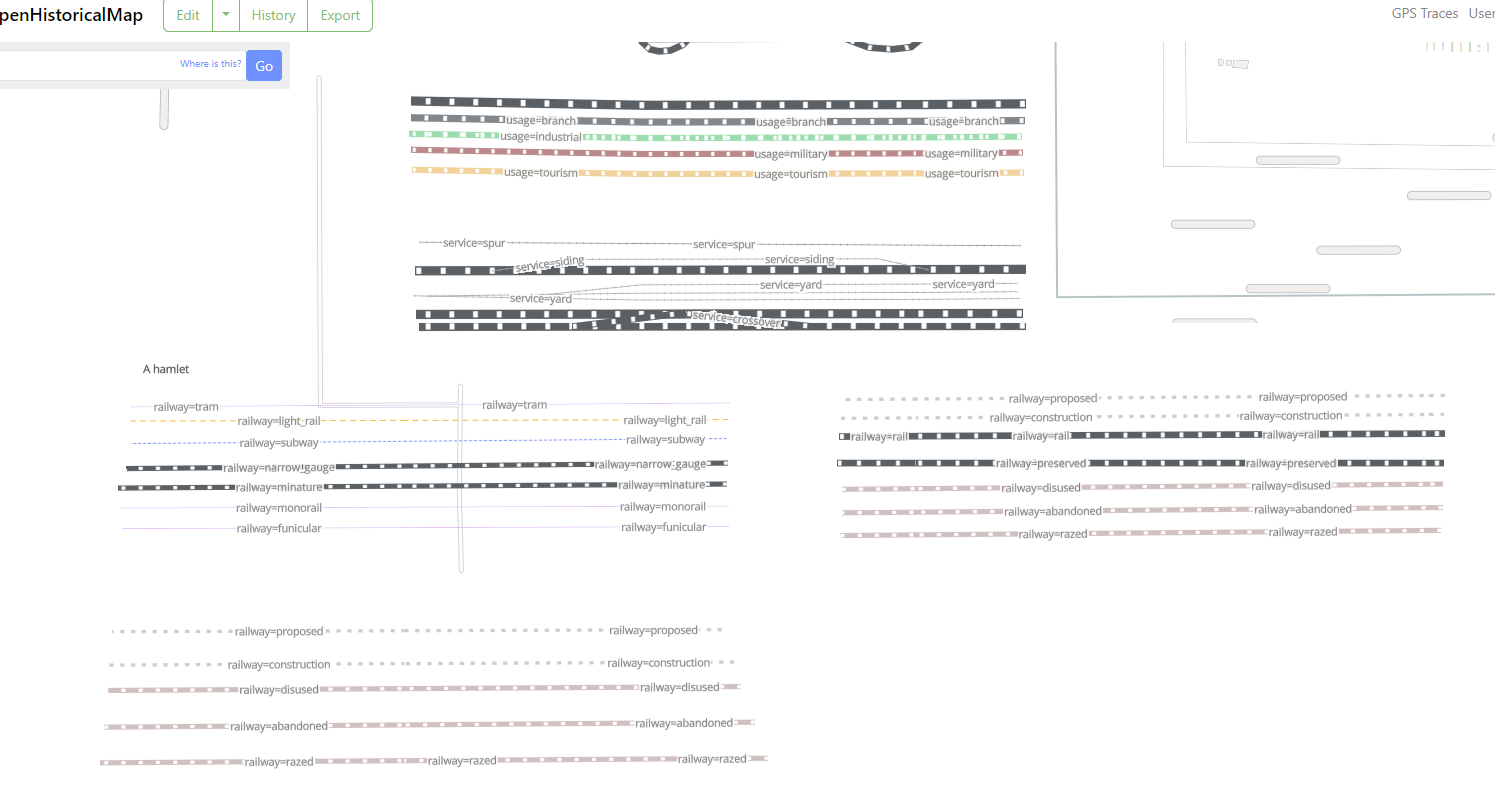
- Updated style based on user Bauer’s suggestions (add subway tunnel, subway bridge, separate out light rail from main rail and have corresponding tunnel and bridge styling)
- Also updated other rail stylings with improvements - adjusted spur & yard; adjusted railway abandoned styling and railway “proposed” styling to relate-to main railway styling
- Adjusted tram, funicular styling and subway, light_rail styling to be in similar “category” of styling (a thinner dashed line). My “Design Category” is “inside/inner city rail-based transit”.
- Adjusted subway, now shows up sooner in railway style
- Added rail station icon:
Are you interested in contributing to future changes in the Railway Style? Fill out our survey!
Historical (Main)

- Added ferry routes
- Adjusted when rail stations come in (earlier zoom level)
- Adjusted canal styling
- Improved glacier styling
Data

- Railway usage type attributes. have been updated in vtiles. “Railway usage” is now storage in the
usageattribute, rather than how it previous was stored (name=usage-x - We have replaced administrative boundary polygons with lines, to help avoid unnecessary overlaps when styling different admin levels. Additionally, we have created new name centroids for admin labels that previously tessellated across a polygon. Read more about this work in this ticket. The lines and centroids data are called
land_ohm_linesandland_ohm_centroidsin the vtiles. With this data update, we have removedland_ohmfrom the vtiles. - We recommend using
land_ohm_centroidsalongsideplace_pointsto label admin areas (ex: country, state, county).land_ohm_centroidsis not duplicating anyplace_pointslabels. Future work will gather the points into one data layer. - We have also added in Natural Earth water areas for zoom 0-8