Migrating this conversation over to this forum. I recently discovered a series of situation maps from WWII that show, in essence, the boundary between Vichy France and the Free French Government as it changed daily as well as the reduction of the German occupation zone and the beginnings of the Allied occupation zone in Germany
416 boundary changes seemed excessive so I wanted to get opinions on the best way to represent such situations while still showing that there was some co-existence between these various entities and one did not just instantly take over from the other after the peace treaty.
@jeffmeyer helped me work through a potential solution:
*Territorial changes will be represented one to two times per month by a polygon or polygons appropriate to the type of territorial change
*The front line or line of contact will be represented by a line that may be updated as frequently as daily
2 Likes
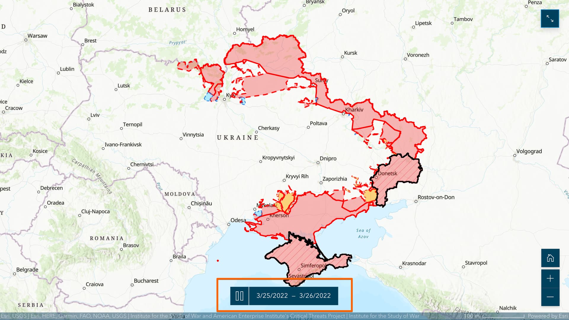
Here are - sadly - some comparables of how to map evolving conflicts from those following the war on Ukraine & in Sudan.
It seems the key terms/descriptors are “control of terrain” or “occupation”.
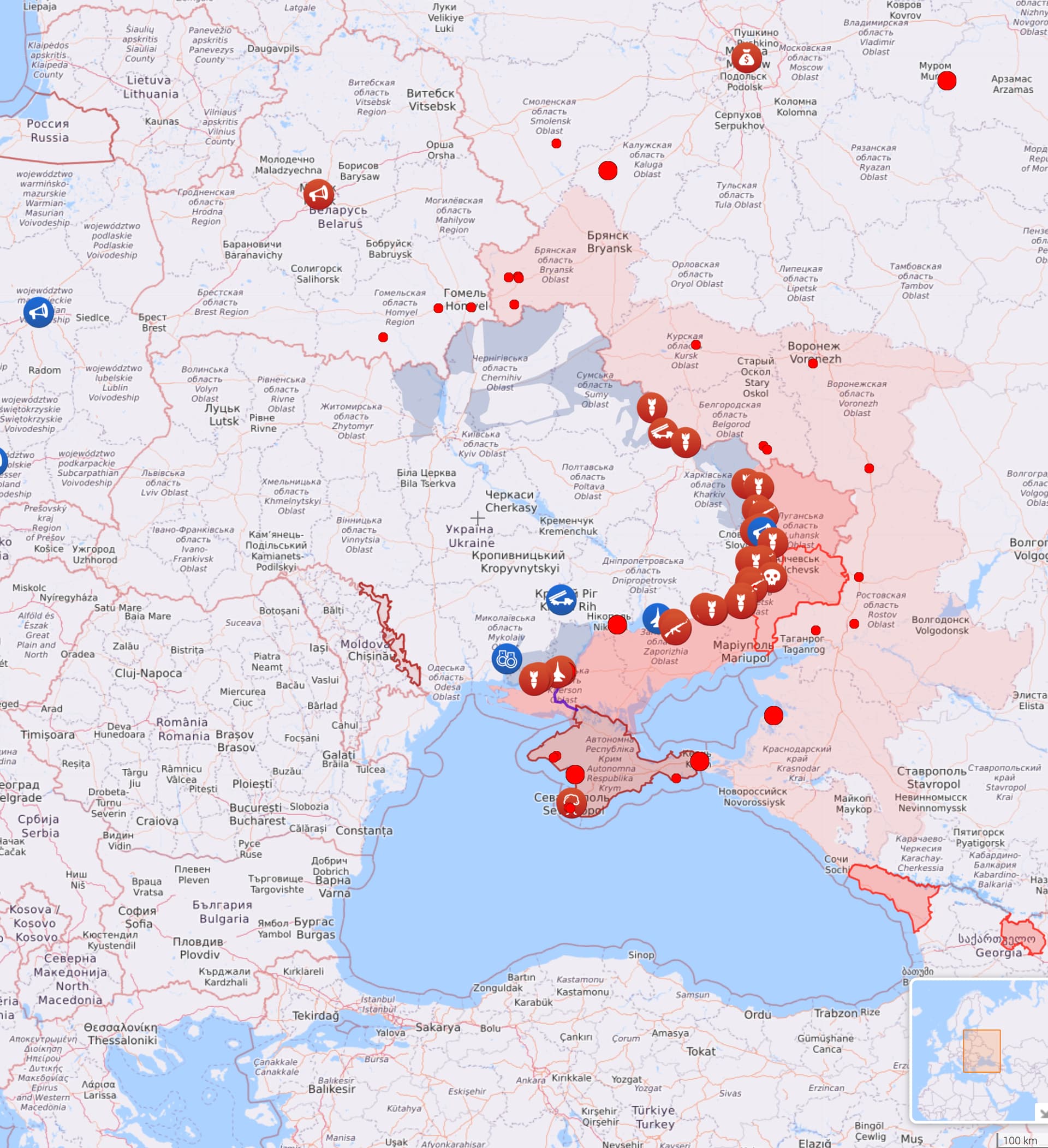
LiveUAMap
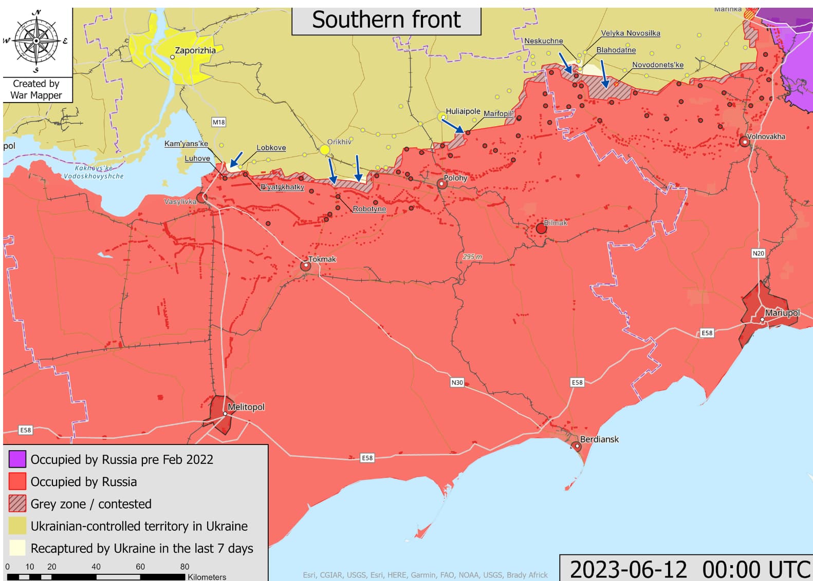
Warmapper
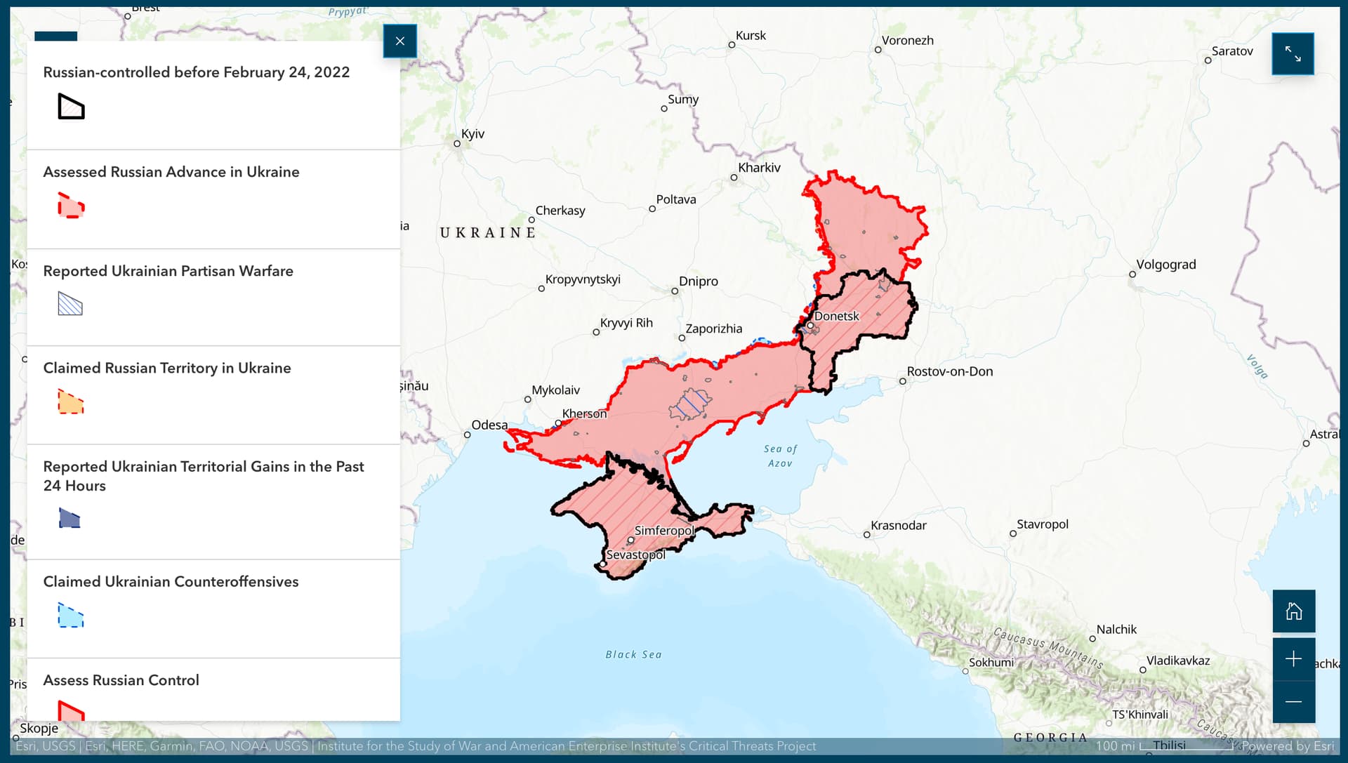
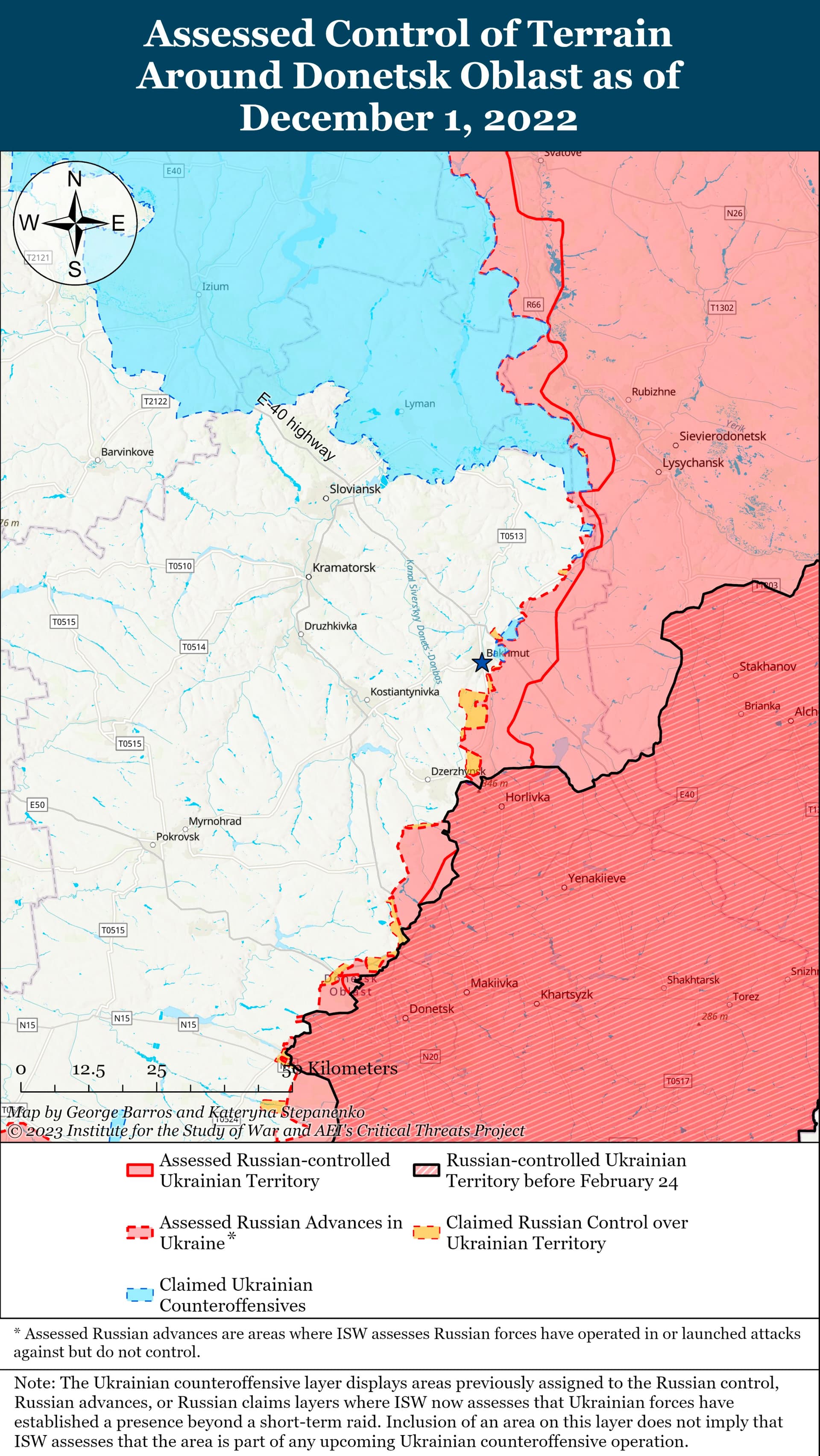
Institute for the Study of War
As you can see, some of these groups are following this at a very fine level of detail:
And, a very interesting timelapse:
So, even if we we didn’t rely on @okiewxchaser’s efforts to translate those situation maps from WWII, I do think there’s a question of what we would want to do if someone donated daily shapefile snapshots from any modern crisis.
- Frequency of changes
- Elements to include - areas, lines, conflicts?
- Cartographic treatment
- what else?
There’s some discussion of this topic, but at a far less frequent update tempo: OHM Issue #553: Need a way of highlighting disputed/contested areas
1 Like
Okay so here is my attempt to document the Danish occupation zone as a test run. I included tags for both a new “boundary” and for a “military area” polygon with the thought that we could decide on which one fits the best and move forward consistently
1 Like
This would be a great opportunity to create chronology relations so that users can easily navigate among the changes. Eventually, the website could interactively visualize each change on the map.
1 Like