Yes, you read that right. I think it might be possible to import every currently existing building (and maybe even some former ones) in the Netherlands, including start_date. I will need some help with that though, as I’ve never done an import before, let alone one of such a scale.
First, as this is my first post on the forum, let me shortly introduce myself. In the past 8 months, I’ve been adding things on OHM all around the world, but mostly in the Netherlands. My main focus has been my hometown of Zwijndrecht. I’ve read a lot about its history, which I knew very little about before. It feels like, as a result, I appreciate my town much more than ever before. Now, when I cycle through certain neighbourhoods or past certain buildings, I know all kinds of stories about them.
A nice side project has been the fortified city of Willemstad, which I visited for the first time in the process of mapping it. It was a peculiar experience to walk around the city, which felt both new and familiar at the same time because of the research I had done on it already.
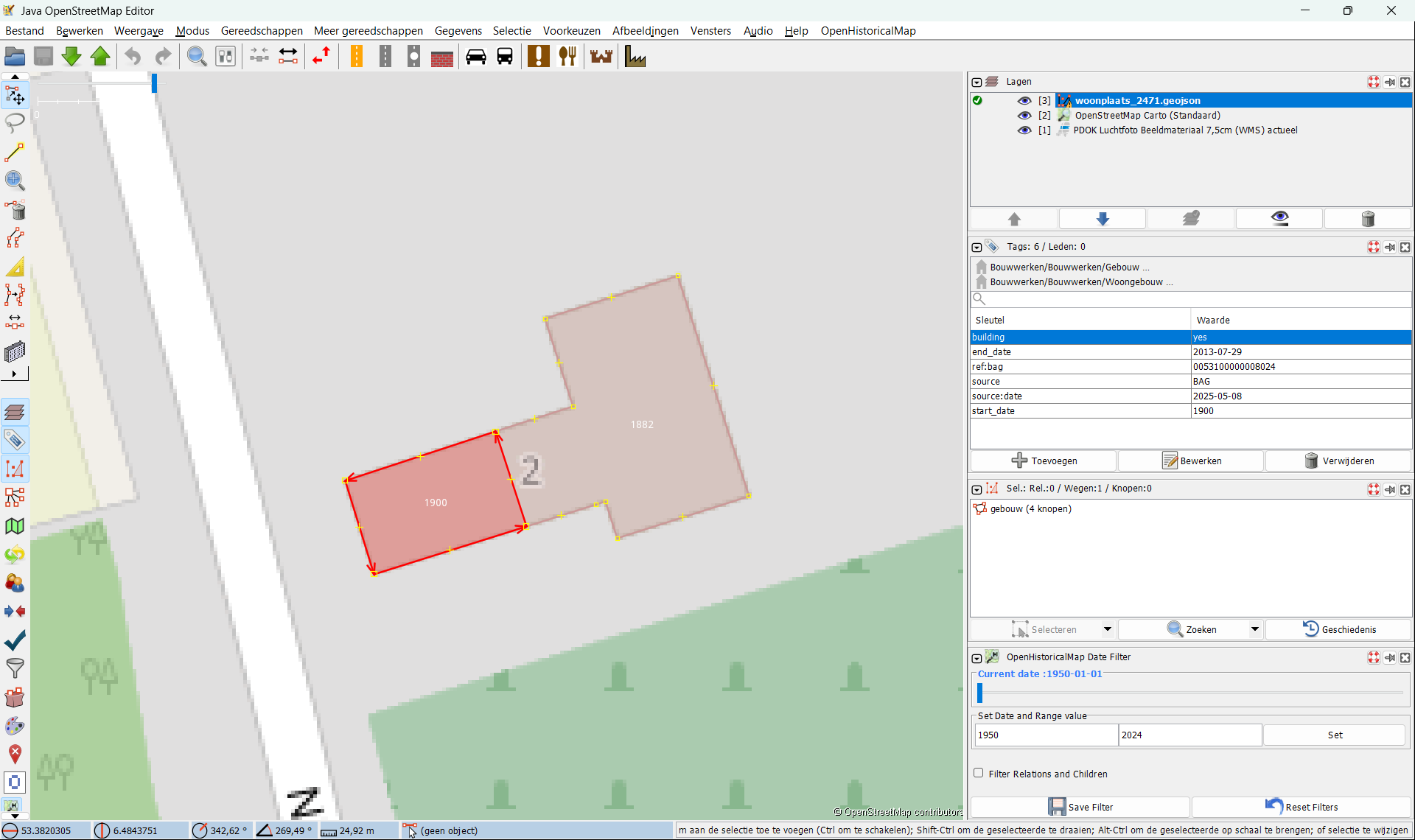
When adding buildings, I’ve often relied on the BAG Viewer for the start_date. This database, maintained by the Dutch government, includes the year of construction of every currently standing building in the Netherlands.
Recently, I found out the BAG database is also available as a downloadable public domain dataset on nationaalgeoregister.nl. This means it could be imported to OHM, as it also uses a public domain licence. I think this would be a huge improvement to mapping the history of the Netherlands. It would provide a base layer of sorts, on top of which historic things can be added. It also means mappers in the Netherlands can devote a lot of the time spent on mapping buildings to other things, such as highways and landcover.
It appears that even some no longer existing buildings are in the BAG database. I found out about this when I revisited buildings I mapped some time ago which have since been removed. See, for example, this one on BAG Viewer (on OHM here). I have not found a way to make these buildings show up on the map of the BAG Viewer though. And they also don’t appear to be included in the dataset on nationaalgeoregister.nl. Maybe we could contact the people at BAG about this.
I also think it could be beneficial to contact the Dutch OpenStreetMap community. They imported the BAG in 2013 and still use it to update the map with new buildings. Maybe we could make use of the plugin they’ve created for this. (See this wiki page for more information. Only in Dutch, so you might need a translation service to read it.)
But first I wanted to let the OHM community know about this. Maybe users with more experience with imports have some advice. I’m very excited about this idea, but I also have a lot of questions about how to approach such an import. Practical issues, like what file format to use and how to import such a large dataset without crashing JOSM. But I also wonder about other things, such as what we would need to do with existing buildings that are also in the dataset: delete them or connect their nodes to the buildings from BAG, so edit history isn’t lost? Another thing we’d need to decide is how to tag the imported buildings.
Anyway, I’d like to hear what you all think about this! I really think the import could be an enormous improvement to the map and make mapping in the Netherlands a lot easier.